Madlitz-Wilmersdorf | |
|---|---|
Location of Madlitz-Wilmersdorf | |
 Madlitz-Wilmersdorf 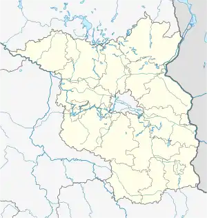 Madlitz-Wilmersdorf | |
| Coordinates: 52°23′N 14°17′E / 52.383°N 14.283°E | |
| Country | Germany |
| State | Brandenburg |
| District | Oder-Spree |
| Disbanded | 2014 |
| Area | |
| • Total | 45.11 km2 (17.42 sq mi) |
| Elevation | 65 m (213 ft) |
| Population (2012-12-31) | |
| • Total | 678 |
| • Density | 15/km2 (39/sq mi) |
| Time zone | UTC+01:00 (CET) |
| • Summer (DST) | UTC+02:00 (CEST) |
| Postal codes | 15518 |
| Dialling codes | 033607 |
| Vehicle registration | LOS |
Madlitz-Wilmersdorf is a former municipality in the Oder-Spree district, in Brandenburg, Germany. It is situated at the Spree river, southwest of Berlin. Since 1 January 2014, it is part of the municipality Briesen.[1]
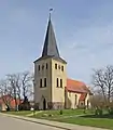 Village church in Alt-Madlitz
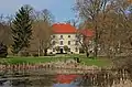 Alt-Madlitz Manor
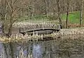 Country park at the manor
References
This article is issued from Wikipedia. The text is licensed under Creative Commons - Attribution - Sharealike. Additional terms may apply for the media files.