Magnolia Square, Los Angeles | |
|---|---|
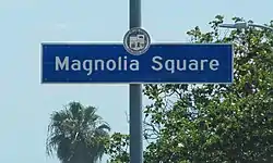
 Magnolia Square Neighborhood Sign on Century Boulevard and Vermont Avenue | |
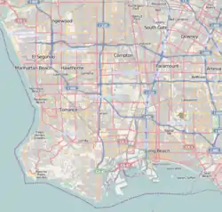
 Magnolia Square, Los Angeles United States Los Angeles Southern | |
| Coordinates: 33°57′36″N 118°17′45″W / 33.960000°N 118.2959017°W | |
| Country | |
| State | |
| County | |
| Time zone | Pacific |
| Zip Code | 90044 |
| Area code | 323 |
Magnolia Square is a neighborhood in Los Angeles, California.
Geography
By city council action in October 2001 (C.F. #01-1874), "Magnolia Square" was officially named and designated as being bounded by the following streets: Century Boulevard on the north, South Vermont Avenue on the west, the Harbor Freeway (I-110) on the east, and Imperial Highway on the south.[1]
The Department of Transportation was instructed to install signage at the following intersections: Figueroa Street at 109th Place, Figueroa at 99th Street, Century Boulevard at Grand Avenue, and Imperial Highway at Vermont Avenue.[2]
History
Beginning in 2000, the Eighth District Empowerment Congress began working on the "Naming Neighborhoods Project" to identify and name individual communities that had historically been grouped together and regarded as part of South Central Los Angeles.[1]
The first focus group was held at Hebrew Union College in June 2000. Through research, a meeting with an urban historian, and numerous community meetings, the Empowerment Congress ultimately outlined sixteen unique neighborhoods, including the neighborhood of Magnolia Square. The names were submitted to City Council in October 2001 and approved in February 2002.[1]
Government
Magnolia Square lies within Los Angeles City Council District 8.[3]
The neighborhood of Magnolia Square is split between two neighborhood councils: the Empowerment Congress Southeast Area Neighborhood Council serves Magnolia Square residents Century Boulevard and 110th Street [4][5] and the Harbor Gateway North Neighborhood Council serves the area between 110th Street and Imperial Boulevard. [6][7]
Parks and recreation

Two public parks are located within the boundaries of Magnolia Square:
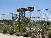
- Little Green Acres Park-Community Garden, 104th Street and Vermont Avenue[8]
- 105th Street Pocket Park, 609 West 105th Street [9]
Education
Two public schools are located within the boundaries of Magnolia Square:
External links
- "Los Angeles - Magnolia Square Neighborhood Map". zipdatamaps.com. Retrieved 13 May 2022.
- A Los Angeles Times Magazine story exploring the smells of the city. [12]
References
- 1 2 3 "Council File 01-1874" (PDF). No. 40. City of Los Angeles. October 2001. Retrieved 31 August 2020.
- ↑ "Coucil Fire 01-1874" (PDF). No. 41. City of Los Angeles. February 15, 2002. Retrieved 31 August 2020.
- ↑ "Council District 8 Map" (PDF). Retrieved 3 May 2022.
- ↑ "South East Area Neighborhood Council". Retrieved 3 May 2022.
- ↑ "South East Area Neighborhood Council Boundary Map". Retrieved 3 May 2022.
Area 2 - Magnolia Square
- ↑ "Harbor Gateway North Neighborhood Council". Retrieved 3 May 2022.
- ↑ "Harbor Gateway North Neighborhood Council Boundary Map". Retrieved 3 May 2022.
- ↑ Los Angeles Department of Recreation and Parks: Little Green Acres
- ↑ Los Angeles Department of Recreation and Parks: 105th Street Pocket Park
- ↑ "Figueroa Street Elementary School". Figueroa-elem.com. Retrieved 3 May 2022.
Figueroa Street Elementary School, 510 W 111th St, Los Angeles, CA 90044
- ↑ "Washington Primary Center". LAUSD. Retrieved 3 May 2022.
Washington Primary Center-Washington primary dual language center, 860 W. 112th Street Los Angeles, California 90044
- ↑ Oji, Qevin (April 23, 2006). "Follow Your Nose". Los Angeles Times. Retrieved 13 May 2022.
Heading east on Century Boulevard, I passed a city sign: "Magnolia Square." I wondered whose dream it was to line this street with magnolias, wondered when the first one was chopped down and replaced by a sidewalk-busting ficus.
