Maneshwara
मानेश्वरा | |
|---|---|
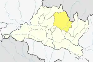
 Maneshwara Location in Nepal | |
| Coordinates: 27°49′N 85°52′E / 27.81°N 85.86°E | |
| Country | |
| Zone | Bagmati Zone |
| District | Sindhupalchok District |
| Population (2011[1]) | 3,393 |
| • Religions | Hindu |
| Time zone | UTC+5:45 (Nepal Time) |
Maneshwara is a village in Sindhupalchok District in the Bagmati Zone of central Nepal. At the time of the 1991 Nepal census, it had a population of 3,065, and had 642 houses in the village.[2] By 2011 the population had become 3,393 (1,816 females and 1,577 males) in 789 households.[1]
References
- 1 2 "SINDHUPALCHOWK" (PDF). National Population and Housing Census 2011 (Village Development Committee/Municipality). Kathmandu, Nepal: Central Bureau of Statistics (CBS), National Planning Commission Secretariat, Government of Nepal (published 2018). 19 March 2014. Table 2.1: Households, population and average household size. Data for "Maneswnara". Retrieved 2019-06-25 – via https://cbs.gov.np/vdc-municipality-in-detail/.
{{cite web}}: External link in|via= - ↑ "Nepal Census 2001". Nepal's Village Development Committees. Digital Himalaya. Data for "Maneswor". Archived from the original on 2008-10-12. Retrieved 2008-08-24.
This article is issued from Wikipedia. The text is licensed under Creative Commons - Attribution - Sharealike. Additional terms may apply for the media files.