Manokwari Regency
Kabupaten Manokwari | |
|---|---|
 Coat of arms | |
 Location in West Papua | |
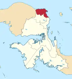
 Manokwari Regency Location in Indonesia | |
| Coordinates: 0°51′46″S 134°03′50″E / 0.8629°S 134.0640°E | |
| Country | Indonesia |
| Province | West Papua |
| Regency seat | Manokwari |
| Government | |
| • Regent | vacant |
| • Vice Regent | Edy Budoyo |
| Area , on post-2013 boundaries | |
| • Total | 3,168.28 km2 (1,223.28 sq mi) |
| Population (mid 2022 estimate)[1] | 200,785 |
| Time zone | UTC+9 (IEST) |
| Area code | (+62) 986 |
| Website | manokwarikab |
Manokwari Regency is a regency in West Papua, Indonesia. Following the splitting away of twenty of its former districts in 2013, it now covers an area of 3,168.28 km2 and had a population of 192,663 at the 2020 Census;[2] the official estimate as at mid 2022 was 200,785.[1] The administrative centre (regency seat) is presently at the town of Manokwari, which is also the capital of the province, but under proposals currently under consideration by the Indonesian Parliament, the town is intended to be split off from the regency to form a separate independent city.
Administration
At the 2010 Census, Manokwari Regency comprised 29 districts (Kecamatan) with an area of 34,970 km2 and a 2010 Census population of 187,726,[3] but in 2013 two new regencies - South Manokwari Regency (Manokwari Selatan) with six districts, and Arfak Mountains Regency (Pegunungan Arfak) with ten districts - were created from parts of the Manokwari Regency, while the most westerly four districts (Kebar, Amberbaken, Mubrani and Senopi, which were the largest in area of the remaining districts, although sparsely populated) were removed from Manokwari Regency and added to the Tambrauw Regency.
The residual area of Manokwari Regency thus comprised nine districts, listed below with their areas and their populations at the 2010 Census[3] and the 2020 Census,[2] together with the official estimate as at mid 2022.[1] The table also includes the location of the district centres, the number of administrative villages in each district (totaling 164 rural kampung and 9 urban kelurahan), and its postal code.
| Kode Kemendagri | Name of District (distrik) | Area in km2 | Pop'n Census 2010 | Pop'n Census 2020 | Pop'n Estimate mid 2022 | Admin centre | No. of villages | Post code |
|---|---|---|---|---|---|---|---|---|
| 92.02.03 | Warmare | 674.84 | 6,192 | 8,993 | 9,492 | Dindey | 31 | 98317 |
| 92.02.04 | Prafi | 311.13 | 14,240 | 17,783 | 18,607 | Udapi Hilir | 16 | 98316 (a) |
| 92.02.12 | Manokwari Barat (West Manokwari) | 93.46 | 74,996 | 95,837 | 99,774 | Sanggeng | 10 (b) | 98312 (c) |
| 92.02.13 | Manokwari Timur (d) (East Manokwari) | 32.00 | 8,988 | 12,735 | 13,224 | Pasir Putih | 7 (e) | 98311 (f) |
| 92.02.14 | Manokwari Utara (g) (North Manokwari) | 450.53 | 2,248 | 4,191 | 4,365 | Lebau | 22 | 98314 |
| 92.02.15 | Manokwari Selatan(h) (South Manokwari) | 450.53 | 13,256 | 25,239 | 27,019 | Anday | 18 (i) | 98313 |
| 92.02.17 | Tanah Rubuh | 271.52 | 2,114 | 3,817 | 4,086 | Warkapi | 24 | 98315 |
| 92.02.05 | Masni | 596.90 | 13,540 | 17,485 | 17,965 | Sumber Boga | 33 | 98318 |
| 92.02.21 | Sidey | 426.77 | 4,390 | 6,583 | 6,553 | Sidey | 12 | 98319 |
| Total | 3,168.28 | 139,964 | 192,663 | 200,785 | 173 |
Notes: (a) except for the village of Mebji, with a post code of 98315. (b) comprising 6 kelurahan and 4 desa.
(c) except for the villages of Manokwari Timur (with a post code of 98311) and Amban (with a post code of 98314).
(d) includes the offshore islands of Pulau Lemon and Pulau Mansinam. (e) includes one kelurahan - Pasir Putih. (f) except for the two villages of Arowi and Pasir Putih (with a post code of 98313).
(g) includes the offshore islands of Pulau Irbor, Pulau Irbor Utara, Pulau Kaki and Pulau Waisupi. (h) includes the offshore island of Pulau Raimuti. (i) including 2 kelurahan.
References
External links
Regencies and cities of West Papua | ||
|---|---|---|
Capital: Manokwari | ||
| Regencies | ||