| Marleston Adelaide, South Australia | |||||||||||||||
|---|---|---|---|---|---|---|---|---|---|---|---|---|---|---|---|
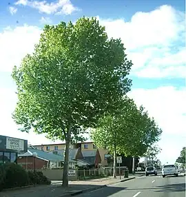
 Looking north along South Road, Marleston is to the west. | |||||||||||||||
| Population | 1,950 (SAL 2021)[1] | ||||||||||||||
| Postcode(s) | 5033 | ||||||||||||||
| LGA(s) | City of West Torrens | ||||||||||||||
| State electorate(s) | Badcoe | ||||||||||||||
| Federal division(s) | Adelaide | ||||||||||||||
| |||||||||||||||
Marleston is a suburb of Adelaide, South Australia, in the City of West Torrens. Marleston was home to 1,950 people at the 2021 census.
The earliest European settler in this area was Donald McLean, who selected Section 50, Hundred of Adelaide, of 80 acres (32 ha) in 1837, (the area was originally part of Hilton) and with his family ploughed and sowed 20 acres of seed wheat, and in 1838 reaped the first harvest of wheat in South Australia. The McLean property was dvided into nine allotmennts of 8.75 acres in the 1860s. John Marles bought allotment 7 in 1874 and subdivided it in 1879.[2] Following World War I, there was a housing boom driven by returned servicemen. Town Planner Charles Reade persuaded several land owners to work together and developed Galway Gardens on garden suburb principles.[3]
Demographics
The 2021 Census by the Australian Bureau of Statistics counted 1,950 persons in Marleston on census night. Of these, 49.0% were male and 50.8% were female.[4]
The majority of residents (58.5%) are of Australian birth, with other common census responses being India (7.6%), China (4.4%), Nepal (2.8%), England (2.6%), and Greece (2.3%). Additionally, people of Aboriginal and/or Torres Strait Islander descent made up 1.3% of the suburb.[4]
In terms of religious affiliation, 37.1% attributed themselves to being irreligious, 17.0% of residents attributed themselves to being Catholic, 7.1% attributed themselves to Hinduism, and 6.9% attributed themselves to being Eastern Orthodox.[4]
References
- ↑ Australian Bureau of Statistics (28 June 2022). "Marleston (suburb and locality)". Australian Census 2021 QuickStats. Retrieved 28 June 2022.
- ↑ "Manning index of South Australian place names:Marleston". State Library of South Australia. Archived from the original on 4 March 2016. Retrieved 19 February 2016.
- ↑ Grainger, Geoff (May 2003). "LH0713-09 MARLESTON, a brief history, compiled May 2003". West Torrens Historical Society. Retrieved 10 October 2023 – via Libraries SA.
- 1 2 3 "2021 Marleston, Census All persons QuickStats | Australian Bureau of Statistics". abs.gov.au. Retrieved 28 June 2022.
34°56′56″S 138°33′47″E / 34.949°S 138.563°E