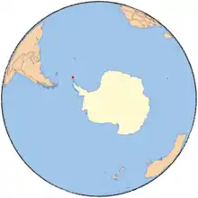
South Orkney Islands.
Marshall Bay (60°39′S 45°38′W / 60.650°S 45.633°W) is a bay 2 nautical miles (4 km), lying between Cape Vik and Cape Hansen on the south side of Coronation Island, in the South Orkney Islands, Antarctica. It was roughly charted in 1912–13 by Petter Sørlle, a Norwegian whaling captain. The bay was recharted in 1933 by Discovery Investigations personnel on the Discovery II, who gave the name for surgeon Dr. E.H. Marshall, a member of the Marine Executive Staff of the Discovery Committee.[1]
References
- ↑ "Marshall Bay". Geographic Names Information System. United States Geological Survey, United States Department of the Interior. Retrieved 15 August 2013.
![]() This article incorporates public domain material from "Marshall Bay". Geographic Names Information System. United States Geological Survey.
This article incorporates public domain material from "Marshall Bay". Geographic Names Information System. United States Geological Survey.
This article is issued from Wikipedia. The text is licensed under Creative Commons - Attribution - Sharealike. Additional terms may apply for the media files.