Gaweinstal | |
|---|---|
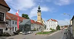 Church Square with the municipal office | |
 Coat of arms | |
 Gaweinstal Location within Austria | |
| Coordinates: 48°29′N 16°35′E / 48.483°N 16.583°E | |
| Country | Austria |
| State | Lower Austria |
| District | Mistelbach |
| Government | |
| • Mayor | Birgit Boyer (ÖVP) |
| Area | |
| • Total | 51.71 km2 (19.97 sq mi) |
| Elevation | 199 m (653 ft) |
| Population (2018-01-01)[2] | |
| • Total | 3,947 |
| • Density | 76/km2 (200/sq mi) |
| Time zone | UTC+1 (CET) |
| • Summer (DST) | UTC+2 (CEST) |
| Postal code | 2191 |
| Area code | 02574 |
| Website | www.gaweinstal.at |
Gaweinstal is a town in the district of Mistelbach in the Austrian state of Lower Austria.
Population
| Year | Pop. | ±% |
|---|---|---|
| 1869 | 1,245 | — |
| 1900 | 1,380 | +10.8% |
| 1951 | 1,117 | −19.1% |
| 1971 | 2,736 | +144.9% |
| 1981 | 2,781 | +1.6% |
| 1991 | 3,024 | +8.7% |
| 2001 | 3,485 | +15.2% |
| 2011 | 3,703 | +6.3% |
| 2021 | 4,022 | +8.6% |
References
- ↑ "Dauersiedlungsraum der Gemeinden Politischen Bezirke und Bundesländer - Gebietsstand 1.1.2018". Statistics Austria. Retrieved 10 March 2019.
- ↑ "Einwohnerzahl 1.1.2018 nach Gemeinden mit Status, Gebietsstand 1.1.2018". Statistics Austria. Retrieved 9 March 2019.
.JPG.webp)
Parish church
Wikimedia Commons has media related to Gaweinstal.
This article is issued from Wikipedia. The text is licensed under Creative Commons - Attribution - Sharealike. Additional terms may apply for the media files.