Wilfersdorf | |
|---|---|
 | |
 Coat of arms | |
 Wilfersdorf Location within Austria | |
| Coordinates: 48°35′N 16°39′E / 48.583°N 16.650°E | |
| Country | Austria |
| State | Lower Austria |
| District | Mistelbach |
| Government | |
| • Mayor | Josef Tatzber |
| Area | |
| • Total | 30.47 km2 (11.76 sq mi) |
| Elevation | 190 m (620 ft) |
| Population (2018-01-01)[2] | |
| • Total | 2,175 |
| • Density | 71/km2 (180/sq mi) |
| Time zone | UTC+1 (CET) |
| • Summer (DST) | UTC+2 (CEST) |
| Postal code | 2193 |
| Area code | 02573 |
| Website | www.wilfersdorf.at |
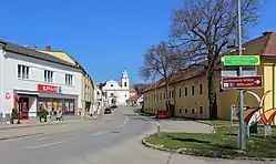
Wilfersdorf is a town in the district of Mistelbach in the Austrian state of Lower Austria.
Wifersdorf Castle is located in the town.
The first recorded reference was in 1514.
Population
| Year | Pop. | ±% |
|---|---|---|
| 1869 | 2,103 | — |
| 1900 | 2,263 | +7.6% |
| 1939 | 2,068 | −8.6% |
| 1951 | 2,138 | +3.4% |
| 1961 | 2,048 | −4.2% |
| 1971 | 2,086 | +1.9% |
| 1981 | 1,906 | −8.6% |
| 1991 | 1,829 | −4.0% |
| 2001 | 2,037 | +11.4% |
| 2011 | 2,124 | +4.3% |
References
- ↑ "Dauersiedlungsraum der Gemeinden Politischen Bezirke und Bundesländer - Gebietsstand 1.1.2018". Statistics Austria. Retrieved 10 March 2019.
- ↑ "Einwohnerzahl 1.1.2018 nach Gemeinden mit Status, Gebietsstand 1.1.2018". Statistics Austria. Retrieved 9 March 2019.
This article is issued from Wikipedia. The text is licensed under Creative Commons - Attribution - Sharealike. Additional terms may apply for the media files.