| Marys Creek Tributary to Haw River | |
|---|---|
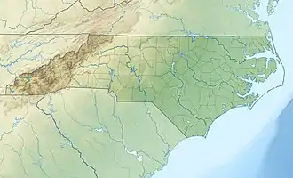 Location of Marys Creek mouth  Marys Creek (Haw River tributary) (the United States) | |
| Location | |
| Country | United States |
| State | North Carolina |
| County | Alamance |
| Physical characteristics | |
| Source | divide between Marys Creek and Varnals Creek |
| • location | about 5 miles southeast of Rock Creek, North Carolina on the west side of Bass Mountain |
| • coordinates | 35°56′27″N 079°24′06″W / 35.94083°N 79.40167°W[1] |
| • elevation | 735 ft (224 m)[2] |
| Mouth | Haw River |
• location | about 3 miles southeast of Saxapahaw, North Carolina |
• coordinates | 35°55′28″N 079°17′56″W / 35.92444°N 79.29889°W[1] |
• elevation | 407 ft (124 m)[1] |
| Length | 9.74 mi (15.68 km)[3] |
| Basin size | 12.51 square miles (32.4 km2)[4] |
| Discharge | |
| • location | Haw River |
| • average | 14.80 cu ft/s (0.419 m3/s) at mouth with Haw River[4] |
| Basin features | |
| Progression | Haw River → Cape Fear River → Atlantic Ocean |
| River system | Haw River |
| Tributaries | |
| • left | unnamed tributaries |
| • right | unnamed tributaries |
| Bridges | Thompson Mill Road, Snow Camp Road, Jewell Road, Lindley Mill Road, Stockland Road, NC 87, Whitney Road |
Marys Creek is a 9.74 mi (15.68 km) long 3rd order tributary to the Haw River, in Alamance County, North Carolina.
Course
Marys Creek rises on the west side of Bass Mountain, about 5 miles southeast of Rock Creek in Alamance County, North Carolina and then flows east to the Haw River about 3 miles southeast of Saxapahaw, North Carolina.[2]
Watershed
Marys Creek drains 12.51 square miles (32.4 km2) of area, receives about 46.6 in/year of precipitation, and has a wetness index of 425.73 and is about 44% forested.[4]
See also
References
- 1 2 3 "GNIS Detail - Marys Creek". geonames.usgs.gov. Locality, LLC. Retrieved 2 October 2019.
- 1 2 "Cane Creek Mountains Topo Map, Alamance County NC (Snow Camp Area)". TopoZone. Locality, LLC. Retrieved 1 October 2019.
- ↑ "ArcGIS Web Application". epa.maps.arcgis.com. US EPA. Retrieved 2 October 2019.
- 1 2 3 "Marys Creek Watershed Report". Waters Geoviewer. US EPA. Retrieved 2 October 2019.
Additional Maps
.jpg.webp)
Course of Marys Creek (Haw River tributary) in Alamance County, North Carolina
.jpg.webp)
Watershed of Marys Creek (Haw River tributary) in Alamance County, North Carolina
This article is issued from Wikipedia. The text is licensed under Creative Commons - Attribution - Sharealike. Additional terms may apply for the media files.