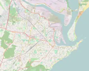
| Mayfield East Newcastle, New South Wales | |||||||||||||||
|---|---|---|---|---|---|---|---|---|---|---|---|---|---|---|---|
 Mayfield East | |||||||||||||||
| Coordinates | 32°53′53″S 151°45′00″E / 32.898°S 151.750°E | ||||||||||||||
| Population | 1,692 (2016 census)[1] | ||||||||||||||
| • Density | 3,400/km2 (8,800/sq mi) | ||||||||||||||
| Postcode(s) | 2304 | ||||||||||||||
| Area | 0.5 km2 (0.2 sq mi) | ||||||||||||||
| Location | 5 km (3 mi) NW of Newcastle | ||||||||||||||
| LGA(s) | City of Newcastle | ||||||||||||||
| Parish | Newcastle | ||||||||||||||
| State electorate(s) | Newcastle | ||||||||||||||
| Federal division(s) | Newcastle | ||||||||||||||
| |||||||||||||||
Mayfield East is a suburb of Newcastle, New South Wales, Australia, located 5 kilometres (3 mi) from Newcastle's central business district. It is part of the City of Newcastle local government area.
History
The Aboriginal people, in this area, the Awabakal, were the first people of this land.[2]
Education
On 32 Crebert Street there is co ed government primary school called Mayfield East Public School[3]
References
- ↑ Australian Bureau of Statistics (27 June 2017). "Mayfield East (State Suburb)". 2016 Census QuickStats. Retrieved 9 February 2018.
- ↑ "Aboriginal Culture". City of Newcastle. Retrieved 8 September 2020.
- ↑ "Home – Mayfield East Public School". mayfielde-p.schools.nsw.gov.au. Retrieved 10 November 2020.
This article is issued from Wikipedia. The text is licensed under Creative Commons - Attribution - Sharealike. Additional terms may apply for the media files.