| McKinley Grove | |
|---|---|
 McKinley Grove | |
| Map | |
 | |
| Geography | |
| Location | Fresno County, California, United States |
| Coordinates | 37°01′N 119°06′W / 37.017°N 119.100°W |
| Elevation | 6,316 ft (1,925 m) |
| Ecology | |
| Dominant tree species | Sequoiadendron giganteum |
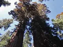
McKinley Grove is a small, isolated giant sequoia grove located about 12 km (7.5 mi) southeast of Dinkey Creek in the Kings River watershed of Sierra National Forest, California. The grove occupies a small bowl-shaped depression at an elevation of 1,925 m (6,316 ft).[1][2]
The grove hosts between 150 and 200 large trees. Parts of the grove were logged in the 1980s, though the heart of the grove remains largely untouched. A short paved path winds through a cluster of about 20 giant sequoias with an open understory of dogwood resembling that of the Giant Forest grove of Sequoia National Park. The grove also features a large fallen giant sequoia.[1]
History
The grove was originally called "Washington Grove" after the 1st president of the United States George Washington. The grove was later named Dusy Grove, after a colourful local settler. Later, the grove was named after the 25th president, William McKinley.[3]
See also
References
- 1 2 "McKinley Grove". www.redwoodhikes.com. Retrieved 2019-11-11.
- ↑ "Mckinley Grove Picnic Site". Sierra National Forest. Retrieved 10 November 2019.
- ↑ "MCKINLEY GROVE GIANT SEQUOIA'S High Sierra Ranger District" (PDF). USDA Forest Service - Pacific Southwest Region. 14 June 2011. Retrieved 10 November 2019.