Meaulne | |
|---|---|
Part of Meaulne-Vitray | |
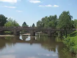 The bridge over the Aumance, in Meaulne | |
 Coat of arms | |
Location of Meaulne | |
 Meaulne  Meaulne | |
| Coordinates: 46°35′57″N 2°36′57″E / 46.5992°N 2.6158°E | |
| Country | France |
| Region | Auvergne-Rhône-Alpes |
| Department | Allier |
| Arrondissement | Montluçon |
| Canton | Bourbon-l'Archambault |
| Commune | Meaulne-Vitray |
| Area 1 | 21.07 km2 (8.14 sq mi) |
| Population (2019)[1] | 771 |
| • Density | 37/km2 (95/sq mi) |
| Time zone | UTC+01:00 (CET) |
| • Summer (DST) | UTC+02:00 (CEST) |
| Postal code | 03360 |
| Elevation | 158–311 m (518–1,020 ft) (avg. 207 m or 679 ft) |
| 1 French Land Register data, which excludes lakes, ponds, glaciers > 1 km2 (0.386 sq mi or 247 acres) and river estuaries. | |
Meaulne (French pronunciation: [mo(l)n]) is a former commune in the Allier department in central France. On 1 January 2017, it was merged into the new commune Meaulne-Vitray.[2]
Population
| Year | Pop. | ±% |
|---|---|---|
| 1962 | 882 | — |
| 1968 | 918 | +4.1% |
| 1975 | 885 | −3.6% |
| 1982 | 823 | −7.0% |
| 1990 | 808 | −1.8% |
| 1999 | 759 | −6.1% |
| 2008 | 775 | +2.1% |
| 2012 | 773 | −0.3% |
| Source: INSEE (1968–2012) | ||
See also
References
- ↑ Téléchargement du fichier d'ensemble des populations légales en 2019, INSEE
- ↑ Arrêté préfectoral 19 July 2016 (in French)
Wikimedia Commons has media related to Meaulne.
This article is issued from Wikipedia. The text is licensed under Creative Commons - Attribution - Sharealike. Additional terms may apply for the media files.