Meedhuizen | |
|---|---|
 Meedhuizen in 2011 | |
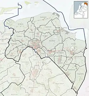
 Meedhuizen Location in the province of Groningen in the Netherlands  Meedhuizen Meedhuizen (Netherlands) | |
| Coordinates: 53°17′N 6°55′E / 53.283°N 6.917°E | |
| Country | Netherlands |
| Province | Groningen |
| Municipality | Eemsdelta |
| Area | |
| • Total | 0.41 km2 (0.16 sq mi) |
| Elevation | −0.5 m (−1.6 ft) |
| Population (2021)[1] | |
| • Total | 390 |
| • Density | 950/km2 (2,500/sq mi) |
| Postal code | 9937[1] |
| Dialing code | 0596 |
Meedhuizen (Dutch pronunciation: [meːtˈɦœyzə(n)]; Gronings: Midhoezen [mɪtˈɦuːzn̩]) is a village in the Dutch province of Groningen. It is a part of the municipality of Eemsdelta, and lies about 24 km east of Groningen.
History
The village was first mentioned in 1306 as Methuisen, and means "middle houses".[3] Meedhuizen originates from the 13th century.[4]
The Dutch Reformed church could date from the 13th century, but has extensively modified in 1703. In 1803, the tower was added and slightly enlarged in 1833.[4]
Meedhuizen was home to 164 people in 1840.[5] The village used to be located between three lakes: Meedhuizermeer, Farmsumermeer and the Proostmeer which were poldered between 1870 and 1900.[5] Between 1869 and 1871, the canal of Duurswold was dug and there was a slight expansion..[4]
Gallery
 Villa Nieuw Oosterbroek
 Village pub
 View on the canal
.jpg.webp) Former school
Former school
References
- 1 2 3 "Kerncijfers wijken en buurten 2021". Central Bureau of Statistics. Retrieved 7 April 2022.
- ↑ "Postcodetool for 9937PA". Actueel Hoogtebestand Nederland (in Dutch). Het Waterschapshuis. Retrieved 7 April 2022.
- ↑ "Meedhuizen (geografische naam)". Etymologiebank (in Dutch). Retrieved 7 April 2022.
- 1 2 3 Ronald Stenvert & Redmer Alma (1998). "Farmsum" (in Dutch). Zwolle: Waanders. ISBN 90 400 9258 3. Retrieved 7 April 2022.
- 1 2 "Meedhuizen". Plaatsengids (in Dutch). Retrieved 7 April 2022.
External links
 Media related to Meedhuizen at Wikimedia Commons