| Meszah Peak | |
|---|---|
 | |
| Highest point | |
| Elevation | 2,164 m (7,100 ft) |
| Prominence | 1,101 m (3,612 ft) |
| Coordinates | 58°28′43.0″N 131°26′13.9″W / 58.478611°N 131.437194°W |
| Geography | |
| Location | British Columbia, Canada |
| District | Cassiar Land District |
| Parent range | Level Mountain Range, Nahlin Plateau (western Stikine Plateau) |
| Topo map | NTS 104J6 Beatty Creek |
| Geology | |
| Mountain type | Volcanic cone |
| Volcanic arc/belt | Northern Cordilleran Volcanic Province |
| Last eruption | Pleistocene |
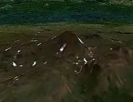
Meszah Peak is a volcanic cone located 66 km (41 mi) north of Telegraph Creek and 136 km (85 mi) southwest of Zus Mountain in British Columbia, Canada. It is the highest peak of the Level Mountain Range, a cluster of bare peaks on the summit of the massive Level Mountain shield volcano, which forms the most voluminous and most persistent eruptive centre in the Northern Cordilleran Volcanic Province.
See also
References
External links
- "Meszah Peak". BC Geographical Names.
- Meszah Peak in the Canadian Mountain Encyclopedia
This article is issued from Wikipedia. The text is licensed under Creative Commons - Attribution - Sharealike. Additional terms may apply for the media files.