| Miass | |
|---|---|
 | |
| Location | |
| Country | Russia |
| Physical characteristics | |
| Mouth | Iset |
• coordinates | 56°05′18″N 64°30′00″E / 56.0882°N 64.5°E |
| Length | 658 km (409 mi) |
| Basin size | 21,800 km2 (8,400 sq mi) |
| Basin features | |
| Progression | Iset→ Tobol→ Irtysh→ Ob→ Kara Sea |
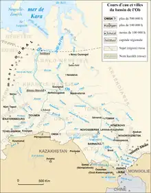
Miass River at the southwest corner of the Ob Basin (double click to expand)
The Miass (Bashkir: Мейәс, Meyäs) is a river on the eastern side of the Ural Mountains in Bashkortostan, Chelyabinsk Oblast and Kurgan Oblast, Russia. It is a right tributary of the Iset, part of the Irtysh basin.[1] It is 149 kilometres (93 mi) long, and has a drainage basin of 13,700 square kilometres (5,300 sq mi).[2] The cities Chelyabinsk and Miass are located on the river.[1][3][4]
References
- 1 2 Миасс (река в Челябинской и Курганской областях), Great Soviet Encyclopedia
- ↑ "Река Миасс in the State Water Register of Russia". textual.ru (in Russian).
- ↑ "Miass". Encyclopaedia Britannica. Retrieved 19 November 2019.
- ↑ "View of the Miass River at Chelyabinsk". World Digital Library. Retrieved 19 November 2019.
External links

The Miass in Chelyabinsk
This article is issued from Wikipedia. The text is licensed under Creative Commons - Attribution - Sharealike. Additional terms may apply for the media files.