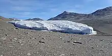
Miers Glacier in 2016
Miers Glacier is a small glacier north of Terminus Mountain in Victoria Land, Antarctica, occupying the upper (western) portion of Miers Valley. The glacier flows eastward with the meltwater from it and Adams Glacier forming Lake Miers. It was mapped and named by the British Antarctic Expedition, 1910–13.[1]
See also
- Aorta Ridge, a ridge that separates upper Miers Glacier from Adams Glacier.
References
- ↑ "Miers Glacier". Geographic Names Information System. United States Geological Survey, United States Department of the Interior. Retrieved 24 September 2013.
![]() This article incorporates public domain material from "Miers Glacier". Geographic Names Information System. United States Geological Survey.
This article incorporates public domain material from "Miers Glacier". Geographic Names Information System. United States Geological Survey.
78°5′S 163°40′E / 78.083°S 163.667°E
This article is issued from Wikipedia. The text is licensed under Creative Commons - Attribution - Sharealike. Additional terms may apply for the media files.