| Mill Creek | |
|---|---|
 Mill Creek | |
| Location | |
| Country | United States |
| State | Pennsylvania |
| County | Bucks |
| Township | Doylestown Warrington |
| Physical characteristics | |
| Source | |
| • coordinates | 40°15′47″N 75°9′43″W / 40.26306°N 75.16194°W |
| • elevation | 390 feet (120 m) |
| Mouth | |
• coordinates | 40°16′30″N 75°9′43″W / 40.27500°N 75.16194°W |
• elevation | 217 feet (66 m) |
| Basin size | 4.88 square miles (12.6 km2) |
| Basin features | |
| Progression | Mill Creek → Neshaminy Creek → Delaware River → Delaware Bay |
| River system | Delaware River |
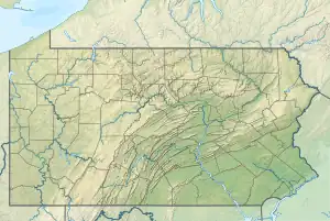
Mill Creek is one of the three tributaries of the Neshaminy Creek bearing the name and one of six Mill Creeks in Bucks County, Pennsylvania.[1] Rising in Doylestown Township, Mill Creek runs about 2 miles (3.2 km) to its confluence at Neshaminy Creek's 36.40 river mile.
Statistics
Mill Creek meets the Neshaminy Creek at the Neshaminy's 36.40 river mile. It drains a Watershed of 4.88 square miles (12.6 km2).The Geographic Name Information System I.D. is 1181119,[2] U.S. Department of the Interior Geological Survey I.D. is 02638.[3]
Course
Rising near the intersection of Limekiln Pike (Pennsylvania Route 152) and Stump Road from an unnamed pond, Mill Creek flows southeast for a very short distance whereupon it runs a little less than 2 miles (3.2 km) picking up two unnamed tributaries from the right, then for a very short distance it curls to the north where it meets the Neshaminy Creek.[4]
Municipalities
Crossings and Bridges
- Bristol Road - NBI Structure Number 7216, bridge is 10 metres (33 ft) long, box beam or girders - single or spread, prestressed concrete, built in 1987.[5]
- Pickertown Road - NBI Structure Number 7495, bridge is 20 metres (66 ft) long, box beam or girders - multiple, prestressed concrete, built in 2004.[6]
See also
References
- ↑ MacReynolds, George, Place Names in Bucks County, Pennsylvania, Doylestown, Bucks County Historical Society, Doylestown, PA, 1942, P229.
- ↑ "Domestic Names".
- ↑ http://www.lycoming.edu/cwi/pdfs/paGazetterOfStreams.pdf, page 97
- ↑ "Google Maps".
- ↑ www.nationalbridges.com https://web.archive.org/web/20131031210639/http://nationalbridges.com/. Archived from the original on 31 October 2013. Retrieved 1 July 2017.
{{cite web}}: Missing or empty|title=(help) - ↑ www.nationalbridges.com https://web.archive.org/web/20131031210639/http://nationalbridges.com/. Archived from the original on 31 October 2013. Retrieved 1 July 2017.
{{cite web}}: Missing or empty|title=(help)