Mill Township | |
|---|---|
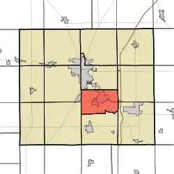
 Location of Mill Township in Grant County | |
| Coordinates: 40°28′53″N 85°37′05″W / 40.48139°N 85.61806°W | |
| Country | United States |
| State | Indiana |
| County | Grant |
| Government | |
| • Type | Indiana township |
| Area | |
| • Total | 23.19 sq mi (60.1 km2) |
| • Land | 23.18 sq mi (60.0 km2) |
| • Water | 0.01 sq mi (0.03 km2) 0.04% |
| Elevation | 850 ft (259 m) |
| Population (2010) | |
| • Total | 10,882 |
| • Density | 189.4/sq mi (73.1/km2) |
| GNIS feature ID | 0453626 |
Mill Township is one of thirteen townships in Grant County, Indiana, United States. As of the 2010 census, its population was 10,882 and it contained 4,809 housing units.[1]
Geography
According to the 2010 census, the township has a total area of 23.19 square miles (60.1 km2), of which 23.18 square miles (60.0 km2) (or 99.96%) is land and 0.01 square miles (0.026 km2) (or 0.04%) is water.[1] The streams of Bean Run, City Run, Ethel Run, Long Branch, Octain Creek, Regular Run and Shell Run run through this township.
Cities and towns
Adjacent townships
- Center Township (north)
- Monroe Township (east)
- Jefferson Township (southeast)
- Fairmount Township (south)
- Liberty Township (southwest)
- Franklin Township (west)
Cemeteries
The township contains two cemeteries: Riverside and Walnut Creek.
Major highways
Education
Mill Township residents may obtain a library card from the Gas City-Mill Township Public Library in Gas City.[2]
References
- 1 2 "Population, Housing Units, Area, and Density: 2010 - County -- County Subdivision and Place -- 2010 Census Summary File 1". United States Census. Archived from the original on February 12, 2020. Retrieved May 10, 2013.
- ↑ "Homepage". Gas City-Mill Township Public Library. Retrieved March 7, 2018.
External links
This article is issued from Wikipedia. The text is licensed under Creative Commons - Attribution - Sharealike. Additional terms may apply for the media files.