Millingen aan de Rijn | |
|---|---|
Town and former municipality | |
.JPG.webp) Church in Millingen aan de Rijn | |
 Flag Coat of arms | |
.svg.png.webp) Location in Gelderland | |
| Coordinates: 51°52′N 6°3′E / 51.867°N 6.050°E | |
| Country | Netherlands |
| Province | Gelderland |
| Municipality | Berg en Dal |
| Area | |
| • Total | 10.27 km2 (3.97 sq mi) |
| • Land | 8.66 km2 (3.34 sq mi) |
| • Water | 1.61 km2 (0.62 sq mi) |
| Elevation | 13 m (43 ft) |
| Population (August 2017) | |
| • Total | 5,918 |
| Time zone | UTC+1 (CET) |
| • Summer (DST) | UTC+2 (CEST) |
| Postcode | 6566 |
| Area code | 0481 |
Millingen aan de Rijn (Dutch pronunciation: [ˈmɪlɪŋə(n) aːn də ˈrɛin] ⓘ) is a former municipality and a town in the eastern Netherlands, in the municipality of Berg en Dal (formerly known as Groesbeek).
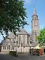 Sint Antonius Church
References
- ↑ "Kerncijfers wijken en buurten 2020" [Key figures for neighbourhoods 2020]. StatLine (in Dutch). CBS. 24 July 2020. Retrieved 19 September 2020.
- ↑ "Postcodetool for 6566EG". Actueel Hoogtebestand Nederland (in Dutch). Het Waterschapshuis. Archived from the original on 21 September 2013. Retrieved 10 July 2014.
External links
 Media related to Millingen aan de Rijn at Wikimedia Commons
This article is issued from Wikipedia. The text is licensed under Creative Commons - Attribution - Sharealike. Additional terms may apply for the media files.