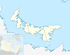
Miminegash | |
|---|---|
 Miminegash in Prince Edward Island | |
| Coordinates: 46°52′48″N 64°13′44″W / 46.880°N 64.229°W | |
| Country | Canada |
| Province | Prince Edward Island |
| County | Prince County |
| Government | |
| • Chairperson | Audrey Callaghan |
| Time zone | AST |
| • Summer (DST) | ADT |
| Area code | 902 |
Miminegash is a rural municipality in Prince Edward Island, Canada.[1] It is located 8 miles (13 km) northwest of Alberton and 11 miles (18 km) southwest of Tignish. It is part of a small area in Lot 3 known as either the St. Louis, Palmer Road, or Miminegash area. This area is often associated with Tignish due to the shared Acadian roots between these areas.
Demographics
In the 2021 Census of Population conducted by Statistics Canada, Miminegash had a population of 148 living in 66 of its 74 total private dwellings, a change of 0% from its 2016 population of 148. With a land area of 1.88 km2 (0.73 sq mi), it had a population density of 78.7/km2 (203.9/sq mi) in 2021.[12]
Community
Miminegash is within 5 miles (8.0 km) of the following communities, known collectively as the St. Louis–Miminegash area. The area was a major source and processing center for Irish Moss harvested locally from the sea. Once processed into carrageenan, it is used as an emulsifier or a source of gloss for things such as ice cream, chocolate milk or lipstick.
- St. Louis
- Palmer Road
- Pleasant View
- Roseville
- St. Lawrence
- Waterford
- Skinner's Pond
- Palmer Road north
- DeBlois
- St. Edward
References
- ↑ "Municipal Councils and Contact Information" (PDF). Government of Prince Edward Island. January 27, 2017. Retrieved February 4, 2017.
- ↑ "Table 2: Population of Census Subdivisions, 1921–1971". 1971 Census of Canada (PDF). Population. Vol. Census Subdivisions (Historical). Ottawa: Statistics Canada. July 1973. Retrieved February 2, 2022.
- ↑ "1976 Census of Canada: Population - Geographic Distributions" (PDF). Statistics Canada. June 1977. Retrieved February 2, 2022.
- ↑ "1981 Census of Canada: Census subdivisions in decreasing population order" (PDF). Statistics Canada. May 1992. Retrieved February 2, 2021.
- ↑ "1986 Census: Population - Census Divisions and Census Subdivisions" (PDF). Statistics Canada. September 1987. Retrieved February 2, 2022.
- ↑ "91 Census: Census Divisions and Census Subdivisions - Population and Dwelling Counts" (PDF). Statistics Canada. April 1992. Retrieved February 2, 2022.
- ↑ "96 Census: A National Overview - Population and Dwelling Counts" (PDF). Statistics Canada. April 1997. Retrieved February 2, 2022.
- ↑ "Population and Dwelling Counts, for Canada, Provinces and Territories, and Census Subdivisions (Municipalities), 2001 and 1996 Censuses - 100% Data (Prince Edward Island)". Statistics Canada. August 15, 2012. Retrieved February 2, 2022.
- ↑ "Population and dwelling counts, for Canada, provinces and territories, and census subdivisions (municipalities), 2006 and 2001 censuses - 100% data (Prince Edward Island)". Statistics Canada. August 20, 2021. Retrieved February 2, 2022.
- ↑ "Population and dwelling counts, for Canada, provinces and territories, and census subdivisions (municipalities), 2011 and 2006 censuses (Prince Edward Island)". Statistics Canada. July 25, 2021. Retrieved February 2, 2022.
- ↑ "Population and dwelling counts, for Canada, provinces and territories, and census subdivisions (municipalities), 2016 and 2011 censuses – 100% data (Prince Edward Island)". Statistics Canada. February 8, 2017. Retrieved February 2, 2022.
- 1 2 "Population and dwelling counts: Canada, provinces and territories, and census subdivisions (municipalities), Prince Edward Island". Statistics Canada. February 9, 2022. Retrieved March 3, 2022.