Mirabel | |
|---|---|
 | |
| Coordinates: 45°39′N 74°05′W / 45.650°N 74.083°W[1] | |
| Country | Canada |
| Province | Quebec |
| Region | Laurentides |
| Effective | 1985[1] |
| Dissolved | 2001 |
| County seat | Mirabel |
| Government | |
| • Type | Prefecture |
| Area | |
| • Total | 489 km2 (189 sq mi) |
| • Land | 485.41 km2 (187.42 sq mi) |
| Population (2001)[2] | |
| • Total | 27,330 |
| • Density | 56.3/km2 (146/sq mi) |
| • Change (1996–2001) | |
| • Dwellings | 10,067 |
| Time zone | UTC−5 (EST) |
| • Summer (DST) | UTC−4 (EDT) |
| Area code | 450 |
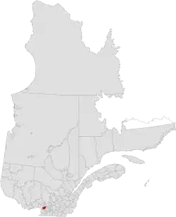
Mirabel was a former regional county municipality whose territory coincided with the city of Mirabel, Quebec. It was established in 1985, whereas the city itself had been constituted in 1971.
It ceased to exist by January 1, 2002, in the midst of the early 2000s municipal reorganization in Quebec. Although the city of Mirabel itself was unaffected, legislation[3] gave newly constituted cities arising from that municipal reorganization the powers of a regional county municipality for the purpose of certain laws, and Mirabel got similar powers. Today, Mirabel is not part of any regional county municipality; for statistical and census purposes, it is considered a territory equivalent to a regional county municipality.
See also
References
- 1 2 3 "Banque de noms de lieux du Québec: Reference number 141052". toponymie.gouv.qc.ca (in French). Commission de toponymie du Québec.
- 1 2 "2001 Census profile: Mirabel".
- ↑ Bill 170 (year 2000)
This article is issued from Wikipedia. The text is licensed under Creative Commons - Attribution - Sharealike. Additional terms may apply for the media files.