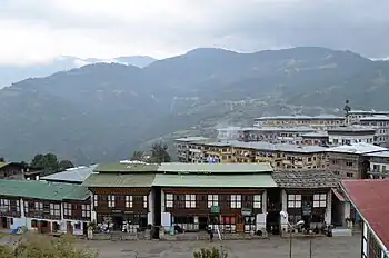

Mongar (Dzongkha: མོང་སྒར) is a town and the seat of Mongar District in eastern Bhutan.[1] As of 2005 it had a population of 3502. Mongar is on the road from Thimphu to Trashigang. It is one of the oldest educational hubs of the country. It has a regional hospital and a good standard hotel, among other facilities. The important Yagang Lhakhang monastery is on the outskirts of the town. The post code for Mongar post office is 43001.[2]
Climate
Mongar features a dry-winter humid subtropical climate (Köppen Cwa).
Pilgrimage གནས་སྐོར།
Entering Mongar district is a door to a multi-destination pilgrimage sites brimming for Buddhist devotees. Thousands of devotees across the country comes here for the purpose of pilgrimage and sigh-seeing holy places.
Sacred Aja Ney and Aja-Ugyen Draphu-Sheridzong Trail
The renowned Aja Ney་(ཨ་རྒྱ་གནས།) is located at an altitude of more than 3,500 meters under Sherimuhung Gewog. The most sacred are the 100 imprints of the sacred syllable “Aa” on the rock-cave left by Guru Rinpoche besides numerous other sacred sites. The Nye also has a medicinal spring which the locals believe can cure 18 diseases besides a nearby pool called Awa Chhu (now known as Uma Chuu). It is said to remove defilements in a person. It takes a minimum of three days to complete a pilgrimage to all the sacred sites.[3]

| Climate data for Mongar, 1996–2018 | |||||||||||||
|---|---|---|---|---|---|---|---|---|---|---|---|---|---|
| Month | Jan | Feb | Mar | Apr | May | Jun | Jul | Aug | Sep | Oct | Nov | Dec | Year |
| Mean daily maximum °C (°F) | 16.6 (61.9) |
19.0 (66.2) |
21.9 (71.4) |
23.8 (74.8) |
25.3 (77.5) |
26.6 (79.9) |
26.7 (80.1) |
27.3 (81.1) |
26.2 (79.2) |
24.4 (75.9) |
20.8 (69.4) |
17.8 (64.0) |
23.0 (73.5) |
| Mean daily minimum °C (°F) | 5.8 (42.4) |
7.5 (45.5) |
10.6 (51.1) |
13.2 (55.8) |
15.3 (59.5) |
17.6 (63.7) |
18.1 (64.6) |
18.1 (64.6) |
17.1 (62.8) |
13.6 (56.5) |
9.9 (49.8) |
7.2 (45.0) |
12.8 (55.1) |
| Average precipitation mm (inches) | 6.0 (0.24) |
10.8 (0.43) |
37.7 (1.48) |
77.6 (3.06) |
92.4 (3.64) |
132.9 (5.23) |
191.5 (7.54) |
159.9 (6.30) |
109.0 (4.29) |
72.7 (2.86) |
3.0 (0.12) |
3.8 (0.15) |
897.3 (35.34) |
| Average precipitation days (≥ 0.1 mm) | 0.9 | 1.6 | 5.4 | 9.0 | 9.7 | 13.1 | 16.8 | 14.4 | 10.4 | 4.4 | 0.9 | 0.8 | 87.4 |
| Source: World Meteorological Organization[4] | |||||||||||||
References
- ↑ National Geospatial-Intelligence Agency
- ↑ Bhutan Post post codes list http://www.bhutanpost.bt/documents/postcodes.pdf Archived 2017-12-26 at the Wayback Machine
- ↑ Newspaper, Bhutan's Daily. "Mesmerizing Mongar: the seven valleys of temples built by sky-dancers, healing pools and of a world heritage dance of drums from Bhutan". Kuensel Online. Retrieved 2023-07-04.
- ↑ "World Weather Information Service". World Meteorological Organization – Mongar. Retrieved November 1, 2022.
External links