Mongiardino Ligure | |
|---|---|
| Comune di Mongiardino Ligure | |
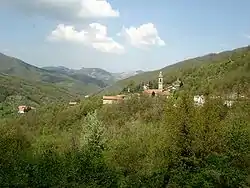
 View of Maggiolo in the comune of Mongiardino Ligure. | |
 Coat of arms | |
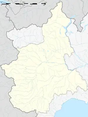
Location of Mongiardino Ligure | |
 Mongiardino Ligure Location of Mongiardino Ligure in Italy  Mongiardino Ligure Mongiardino Ligure (Piedmont) | |
| Coordinates: 44°38′N 9°4′E / 44.633°N 9.067°E | |
| Country | Italy |
| Region | Piedmont |
| Province | Alessandria (AL) |
| Frazioni | Borneto, Camere Nuove, Canarie, Casa di Ragione, Casalbusone, Castellaro, Cavanna, Cerendero, Correio, Fubbiano, Ghiare, Gordena, Gorreto, Lago Cerreto, Lago Patrono (communal seat), Maggiolo, Mandirola, Montemanno, Mulino Cascè, Peio, Piansuolo, Prato, Rovello Inferiore, Rovello Superiore, Salata Mongiardino, Vergagni |
| Government | |
| • Mayor | Alessia Morando |
| Area | |
| • Total | 29.14 km2 (11.25 sq mi) |
| Elevation | 600 m (2,000 ft) |
| Population (31 December 2019)[2] | |
| • Total | 149 |
| • Density | 5.1/km2 (13/sq mi) |
| Demonym | Mongiardinesi |
| Time zone | UTC+1 (CET) |
| • Summer (DST) | UTC+2 (CEST) |
| Postal code | 15060 |
| Dialing code | 0143 |
| Patron saint | St. John the Baptist |
| Saint day | 24 June |
| Website | Official website |
Mongiardino Ligure is a comune (municipality) in the Province of Alessandria in the Italian region Piedmont, located about 120 kilometres (75 mi) southeast of Turin and about 50 kilometres (31 mi) southeast of Alessandria.
References
- ↑ "Superficie di Comuni Province e Regioni italiane al 9 ottobre 2011". Italian National Institute of Statistics. Retrieved 16 March 2019.
- ↑ All demographics and other statistics: Italian statistical institute Istat.
This article is issued from Wikipedia. The text is licensed under Creative Commons - Attribution - Sharealike. Additional terms may apply for the media files.