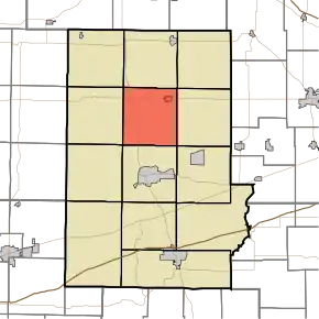
Monroe Township | |
|---|---|
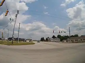 Intersection of U.S. 231 and U.S. 36 in Monroe Township | |
 | |
| Coordinates: 39°43′20″N 86°50′33″W / 39.72222°N 86.84250°W | |
| Country | United States |
| State | Indiana |
| County | Putnam |
| Government | |
| • Type | Indiana township |
| Area | |
| • Total | 34.57 sq mi (89.5 km2) |
| • Land | 34.57 sq mi (89.5 km2) |
| • Water | 0 sq mi (0 km2) |
| Elevation | 902 ft (275 m) |
| Population (2010) | |
| • Total | 1,569 |
| • Density | 45.4/sq mi (17.5/km2) |
| Time zone | UTC-5 (Eastern (EST)) |
| • Summer (DST) | UTC-4 (EDT) |
| Area code | 765 |
| FIPS code | 18-50454[2] |
| GNIS feature ID | 453646 |
Monroe Township is one of thirteen townships in Putnam County, Indiana. As of the 2010 census, its population was 1,569 and it contained 672 housing units.[3]
History
The Brick Chapel United Methodist Church and James Edington Montgomery O'Hair House are listed on the National Register of Historic Places.[4]
Geography
According to the 2010 census, the township has a total area of 34.57 square miles (89.5 km2), all land.[3]
Cities and towns
Unincorporated towns
- Brick Chapel at 39°42′42″N 86°52′09″W / 39.7117122°N 86.8691759°W
- Cary at 39°42′25″N 86°49′23″W / 39.7069903°N 86.8230638°W
(This list is based on USGS data and may include former settlements.)
References
- ↑ "US Board on Geographic Names". United States Geological Survey. October 25, 2007. Retrieved January 31, 2008.
- ↑ "U.S. Census website". United States Census Bureau. Retrieved January 31, 2008.
- 1 2 "Population, Housing Units, Area, and Density: 2010 - County -- County Subdivision and Place -- 2010 Census Summary File 1". United States Census. Archived from the original on February 12, 2020. Retrieved May 10, 2013.
- ↑ "National Register Information System". National Register of Historic Places. National Park Service. July 9, 2010.
External links
Municipalities and communities of Putnam County, Indiana, United States | ||
|---|---|---|
| City | Map of Indiana highlighting Putnam County | |
| Towns | ||
| Townships | ||
| CDPs | ||
| Other communities | ||
| Footnotes | ‡This populated place also has portions in an adjacent county or counties | |
This article is issued from Wikipedia. The text is licensed under Creative Commons - Attribution - Sharealike. Additional terms may apply for the media files.