| Monte Gambarogno | |
|---|---|
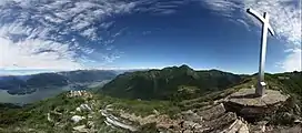 View from the summit | |
| Highest point | |
| Elevation | 1,734 m (5,689 ft) |
| Prominence | 339 m (1,112 ft)[1] |
| Parent peak | Monte Tamaro |
| Isolation | 0.34 km (0.21 mi) |
| Coordinates | 46°06′44″N 8°49′49″E / 46.11222°N 8.83028°E |
| Geography | |
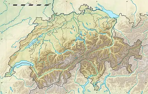 Monte Gambarogno Location in Switzerland | |
| Location | Ticino, Switzerland |
| Parent range | Lugano Prealps |
Monte Gambarogno (1,734 m) is a mountain of the Lugano Prealps, overlooking Lake Maggiore in the canton of Ticino. It lies on the range between Lake Maggiore and Lake Lugano, culminating at Monte Tamaro.
The summit is a popular vantage point and is easily accessible with a road culminating at the Alpe di Neggia (1,395 m).
References
- ↑ Retrieved from the Swisstopo topographic maps. The key col is the Alpe di Neggia (1,395 m).
External links

A view to lake Lago Maggiore and Locarno
![]() Media related to Monte Gambarogno at Wikimedia Commons
Media related to Monte Gambarogno at Wikimedia Commons
This article is issued from Wikipedia. The text is licensed under Creative Commons - Attribution - Sharealike. Additional terms may apply for the media files.