Montfavergier | |
|---|---|
 Coat of arms | |
Location of Montfavergier | |
 Montfavergier 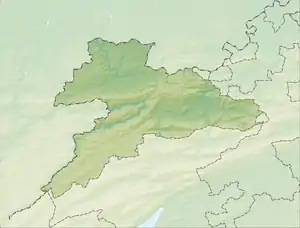 Montfavergier | |
| Coordinates: 47°19′N 07°05′E / 47.317°N 7.083°E | |
| Country | Switzerland |
| Canton | Jura |
| District | Franches-Montagnes |
| Area | |
| • Total | 3.45 km2 (1.33 sq mi) |
| Elevation | 801 m (2,628 ft) |
| Population (2003) | |
| • Total | 34 |
| • Density | 9.9/km2 (26/sq mi) |
| Time zone | UTC+01:00 (Central European Time) |
| • Summer (DST) | UTC+02:00 (Central European Summer Time) |
| Postal code(s) | 2874 |
| SFOS number | 520 |
| Surrounded by | Soubey, Epiquerez, Saint-Brais, Montfaucon, Les Enfers |
| Website | SFSO statistics |
Montfavergier is a former municipality in the district of Franches-Montagnes in the canton of Jura in Switzerland. On 1 January 2009 the former municipality of Montfavergier merged into Montfaucon.[1]
References
- ↑ Amtliches Gemeindeverzeichnis der Schweiz published by the Swiss Federal Statistical Office (in German) accessed 14 January 2010
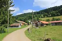
Road through Montfavergier
This article is issued from Wikipedia. The text is licensed under Creative Commons - Attribution - Sharealike. Additional terms may apply for the media files.