Monticello, Florida | |
|---|---|
| City of Monticello | |
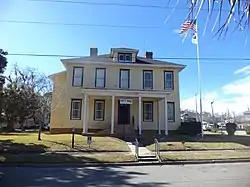
 Monticello City Hall | |
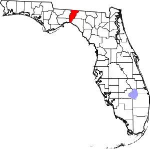
 Location in Jefferson County and the state of Florida | |
| Coordinates: 30°32′41″N 83°52′2″W / 30.54472°N 83.86722°W | |
| Country | |
| State | |
| County | Jefferson |
| Settled | 1827[1] |
| Incorporated | 1859[1] |
| Government | |
| • Type | Commission-Manager |
| • Mayor | Julie Conley |
| • Commissioners | Gloria Cox, John Jones, George Evans, and Katrina Richardson |
| • City Manager | Seth Lawless |
| • City Clerk | Emily Anderson |
| • City Attorney | Bruce Leinback |
| Area | |
| • Total | 4.01 sq mi (10.39 km2) |
| • Land | 4.01 sq mi (10.39 km2) |
| • Water | 0.00 sq mi (0.00 km2) |
| Elevation | 233 ft (71 m) |
| Population (2020) | |
| • Total | 2,589 |
| • Density | 645.31/sq mi (249.17/km2) |
| Time zone | UTC-5 (Eastern (EST)) |
| • Summer (DST) | UTC-4 (EDT) |
| ZIP codes | 32344-32345 |
| Area code | 850 |
| FIPS code | 12-46500[4] |
| GNIS feature ID | 0287080[3] |
| Website | www |
Monticello (/ˌmɒntɪˈsɛloʊ/ ⓘ MON-tiss-EL-oh) is the only city and the county seat of Jefferson County, Florida, United States. The city is named after Monticello, the estate of the county's namesake, Thomas Jefferson, on which the Jefferson County Courthouse was modeled.[5] The population was 2,589 at the 2020 census.
Monticello is home to Indian mounds and many historic buildings, including the Perkins Opera House and Monticello Old Jail Museum.
History and culture
The Perkins Opera House is a 19th-century mercantile building that was adapted for use as a theater. It hosts regular musical performances, as well as theater productions and musicals. The first floor ballroom also holds receptions on a regular basis.
Historic sites
Geography
Monticello is located in northern Jefferson County at 30°32′41″N 83°52′02″W / 30.544612°N 83.867321°W.[6]
U.S. Route 90 runs through the center of the city as Washington Street, leading east 16 miles (26 km) to Greenville and west 26 miles (42 km) to Tallahassee. U.S. Route 19 passes through the city center on Jefferson Street, leading south 10 miles (16 km) to Capps and north 22 miles (35 km) to Thomasville, Georgia. The two highways meet in the center of Monticello at Courthouse Circle, which surrounds the Jefferson County Courthouse. US-19 leads south from the courthouse 5 miles (8 km) to Interstate 10 at Exit 225. I-10 leads west 25 miles (40 km) to Tallahassee and east 82 miles (132 km) to Lake City.
According to the United States Census Bureau, the city has a total area of 4.0 square miles (10.3 km2), all land.
Climate
The climate in this area is characterized by hot, humid summers and generally mild winters. According to the Köppen climate classification, the City of Monticello has a humid subtropical climate (Cfa). Monticello is the site of the highest temperature recorded in Florida, 109 °F (43 °C) on June 29, 1931.
| Climate data for Monticello 5 SE, Florida, 1991–2020 normals, extremes 1904–2017 | |||||||||||||
|---|---|---|---|---|---|---|---|---|---|---|---|---|---|
| Month | Jan | Feb | Mar | Apr | May | Jun | Jul | Aug | Sep | Oct | Nov | Dec | Year |
| Record high °F (°C) | 85 (29) |
88 (31) |
92 (33) |
95 (35) |
106 (41) |
109 (43) |
107 (42) |
104 (40) |
103 (39) |
99 (37) |
91 (33) |
84 (29) |
109 (43) |
| Mean daily maximum °F (°C) | 62.7 (17.1) |
67.1 (19.5) |
73.3 (22.9) |
79.1 (26.2) |
85.7 (29.8) |
89.6 (32.0) |
90.7 (32.6) |
90.1 (32.3) |
87.2 (30.7) |
80.3 (26.8) |
71.4 (21.9) |
65.1 (18.4) |
78.5 (25.8) |
| Daily mean °F (°C) | 51.5 (10.8) |
54.8 (12.7) |
60.7 (15.9) |
66.5 (19.2) |
73.4 (23.0) |
79.1 (26.2) |
80.9 (27.2) |
80.5 (26.9) |
77.2 (25.1) |
68.6 (20.3) |
59.4 (15.2) |
53.7 (12.1) |
67.2 (19.6) |
| Mean daily minimum °F (°C) | 40.3 (4.6) |
42.5 (5.8) |
48.1 (8.9) |
53.9 (12.2) |
61.1 (16.2) |
68.6 (20.3) |
71.0 (21.7) |
70.9 (21.6) |
67.2 (19.6) |
56.9 (13.8) |
47.5 (8.6) |
42.4 (5.8) |
55.9 (13.3) |
| Record low °F (°C) | 3 (−16) |
14 (−10) |
18 (−8) |
31 (−1) |
38 (3) |
44 (7) |
54 (12) |
58 (14) |
36 (2) |
28 (−2) |
13 (−11) |
7 (−14) |
3 (−16) |
| Average precipitation inches (mm) | 4.81 (122) |
4.01 (102) |
5.29 (134) |
4.12 (105) |
3.82 (97) |
7.62 (194) |
7.49 (190) |
7.53 (191) |
5.46 (139) |
3.31 (84) |
2.79 (71) |
3.68 (93) |
59.93 (1,522) |
| Average precipitation days (≥ 0.01 in) | 9.1 | 7.4 | 9.2 | 6.4 | 5.8 | 11.7 | 15.0 | 13.2 | 8.7 | 5.0 | 5.8 | 7.7 | 105.0 |
| Source 1: NOAA[7] | |||||||||||||
| Source 2: WRCC (extremes)[8] | |||||||||||||
Demographics
| Census | Pop. | Note | %± |
|---|---|---|---|
| 1850 | 329 | — | |
| 1860 | 1,083 | 229.2% | |
| 1870 | 1,052 | −2.9% | |
| 1890 | 1,218 | — | |
| 1900 | 1,076 | −11.7% | |
| 1910 | 1,829 | 70.0% | |
| 1920 | 1,704 | −6.8% | |
| 1930 | 1,901 | 11.6% | |
| 1940 | 2,042 | 7.4% | |
| 1950 | 2,264 | 10.9% | |
| 1960 | 2,490 | 10.0% | |
| 1970 | 2,473 | −0.7% | |
| 1980 | 2,994 | 21.1% | |
| 1990 | 2,573 | −14.1% | |
| 2000 | 2,533 | −1.6% | |
| 2010 | 2,506 | −1.1% | |
| 2020 | 2,589 | 3.3% | |
| U.S. Decennial Census[9] | |||
| Race | Pop 2010[10] | Pop 2020[11] | % 2010 | % 2020 |
|---|---|---|---|---|
| White (NH) | 1,058 | 1,208 | 42.22% | 46.66% |
| Black or African American (NH) | 1,349 | 1,242 | 53.83% | 47.97% |
| Native American or Alaska Native (NH) | 0 | 5 | 0.00% | 0.19% |
| Asian (NH) | 17 | 7 | 0.68% | 0.27% |
| Pacific Islander or Native Hawaiian (NH) | 0 | 3 | 0.00% | 0.12% |
| Some other race (NH) | 0 | 5 | 0.00% | 0.19% |
| Two or more races/Multiracial (NH) | 29 | 70 | 1.16% | 2.70% |
| Hispanic or Latino (any race) | 53 | 49 | 2.11% | 1.89% |
| Total | 2,506 | 2,589 | 100.00% | 100.00% |
As of the 2020 United States census, there were 2,589 people, 1,120 households, and 711 families residing in the city.[12]
In 2020, the median household income was $43,780. 27.3% of the population 25 years and older had a Bachelor’s Degree or higher. There was a 49.2% employment rate. There were 1,323 housing units.[13]
As of the 2010 United States census, there were 2,506 people, 770 households, and 559 families residing in the city.[14]
Notable people
- James Patton Anderson, commander of the 1st Florida Infantry Regiment during the American Civil War, lived in Monticello.[15]
- Bobby Thigpen -- Major League Baseball relief pitcher, set record for most saves in a season (57) in 1990, a record which stood for 18 years
- Willie "Chicken" Thompson -- celebrated mid-late 20th century Chicago White Sox clubhouse manager and chef[16][17]
Education
Jefferson County Schools operates public schools, including Jefferson County Middle / High School.
References
- 1 2 "Monticello (History)". floridanaturecoast.org.
- ↑ "2020 U.S. Gazetteer Files". United States Census Bureau. Retrieved October 31, 2021.
- 1 2 U.S. Geological Survey Geographic Names Information System: Monticello, Florida
- ↑ "U.S. Census website". United States Census Bureau. Retrieved January 31, 2008.
- ↑ Federal Writers' Project (1939), Florida. A Guide to the Southernmost State, New York: Oxford University Press, p. 438
- ↑ "US Gazetteer files: 2010, 2000, and 1990". United States Census Bureau. February 12, 2011. Retrieved April 23, 2011.
- ↑ "Summary of Monthly Normals 1991-2020". National Oceanic and Atmospheric Administration. Retrieved June 25, 2021.
- ↑ "MONTICELLO WTP, FLORIDA (085879)". Western Regional Climate Center. Retrieved March 3, 2021.
- ↑ "Census of Population and Housing". Census.gov. Retrieved June 4, 2015.
- ↑ "P2 HISPANIC OR LATINO, AND NOT HISPANIC OR LATINO BY RACE - 2010: DEC Redistricting Data (PL 94-171) - Monticello, Florida". United States Census Bureau.
- ↑ "P2 HISPANIC OR LATINO, AND NOT HISPANIC OR LATINO BY RACE - 2020: DEC Redistricting Data (PL 94-171) - Monticello, Florida". United States Census Bureau.
- ↑ "S1101 HOUSEHOLDS AND FAMILIES - 2020: Monticello city, Florida". United States Census Bureau.
- ↑ "2020 Decennial Census". United States Census Bureau. Retrieved March 13, 2023.
- ↑ "S1101 HOUSEHOLDS AND FAMILIES - 2010: Monticello city, Florida". United States Census Bureau.
- ↑ "Western Theater". Military Images. 14 (4): 23–30. January–February 1993. JSTOR 44032491. Retrieved March 13, 2023.
- ↑ Sullivan, Paul "'Last Comiskey' stirs memories of a lovable Chicago White Sox team and its iconic ballpark" Chicago Tribune February 26, 2023
- ↑ Kittle, Ron and Logan, Bob Tales from the Chicago White Sox Dugout: A Collection of the Greatest White Sox Stories Ever Told (Tales from the Team); Sports Publishing, May 1, 2018; ISBN: 978-1683582151
