Mont-ral | |
|---|---|
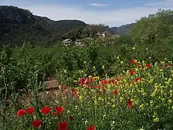 View of La Farena village | |
 Coat of arms | |
 Mont-ral | |
| Coordinates: 41°17′20″N 1°05′56″E / 41.289°N 1.099°E | |
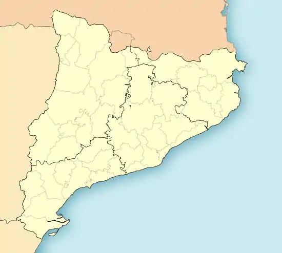
| Country | Spain |
| Autonomous community | Catalonia |
| Province | Tarragona |
| Comarca | Alt Camp |
| Government | |
| • Mayor | Francesc Xavier Pagès Alonso (2015)[1] |
| Area | |
| • Total | 34.7 km2 (13.4 sq mi) |
| Elevation | 888 m (2,913 ft) |
| Population (2018)[3] | |
| • Total | 167 |
| • Density | 4.8/km2 (12/sq mi) |
| Demonym | Mont-ralenc |
| Postal code | 43364 |
| Website | www |
Mont-ral is a municipality in the comarca of Alt Camp, Tarragona, Catalonia, Spain.
The Prades Mountains are located within the municipal boundaries.
History
Mont-ral was part of the Montblanc Vegueria until 1716. Later it became part of the Tarragona Corregiment administrative division.[4]
This municipality had over 1,000 inhabitants during the second half of the 19th century, but has lost almost 80% of its population since then.[2]
Villages
- L'Aixàviga, 14
- El Bosquet, 24
- La Cabrera, 3
- La Cadeneta, 12
- Farena 46
- Mont-ral 81
References
- ↑ "Ajuntament de Mont-ral". Generalitat of Catalonia. Retrieved 2015-11-13.
- 1 2 "El municipi en xifres: Mont-ral". Statistical Institute of Catalonia. Retrieved 2015-11-23.
- ↑ Municipal Register of Spain 2018. National Statistics Institute.
- ↑ Josep M. Calbet & Teresa M. Jové, Alt Camp: marc físic marc humà. Generalitat de Catalunya, Valls, 1983 ISBN 84-300-8291-3
External links
![]() Media related to Mont-ral at Wikimedia Commons
Media related to Mont-ral at Wikimedia Commons
- Official website
- Tourist information
- Government data pages (in Catalan)
Municipalities of Alt Camp | ||
|---|---|---|
This article is issued from Wikipedia. The text is licensed under Creative Commons - Attribution - Sharealike. Additional terms may apply for the media files.