Moorea-Maiao | |
|---|---|
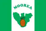
 Flag | |
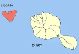
 Location of the commune (in red) within the Windward Islands. The atoll of Maiao lies outside of the map. | |
Location of Moorea-Maiao | |
| Coordinates: 17°31′35″S 149°49′05″W / 17.5263°S 149.818°W | |
| Country | France |
| Overseas collectivity | French Polynesia |
| Subdivision | Windward Islands |
| Government | |
| • Mayor (2020–2026) | Evans Haumani[1] |
| Area 1 | 141.8 km2 (54.7 sq mi) |
| Population (2017) | 17,816 |
| • Density | 130/km2 (330/sq mi) |
| Time zone | UTC−10:00 |
| INSEE/Postal code | 98729 /98728 |
| Elevation | 0–1,207 m (0–3,960 ft) |
| 1 French Land Register data, which excludes lakes, ponds, glaciers > 1 km2 (0.386 sq mi or 247 acres) and river estuaries. | |
Moorea-Maiao is a commune of French Polynesia, an overseas territory of France in the Pacific Ocean. The commune is in the administrative subdivision of the Windward Islands.[2] At the 2017 census it had a population of 17,816.[3]
The commune of Moorea-Maiao is made up of the island of Mo'orea (133 km2/51 sq. miles; 17,463 inhabitants at the 2017 census) and the much smaller atoll of Maiao (8.8 km2/3.4 sq. miles; 353 inhabitants at the 2017 census),[3] located 78 km (48 mi) southwest of Mo'orea.
Moorea-Maiao consists of the following associated communes:
| Commune associée | Area (km2)[4] | Population 2017-08-17[5] | Population density [6] |
|---|---|---|---|
| Afareaitu | 23,8 | 3674 | 154,4 |
| Haapiti | 38,8 | 4254 | 109,6 |
| Pao Pao | 30,0 | 4639 | 154,6 |
| Papetoai | 25,4 | 2329 | 92,8 |
| Teavaro | 15,8 | 2567 | 162,5 |
| Maiao | 8,3 | 353 | 42,5 |
| Commune Moorea-Maiao | 141,8 | 17816 | 125,6 |
The administrative centre of the commune is the settlement of Afareaitu, on the island of Mo'orea.[7]
References
- ↑ "Répertoire national des élus: les maires" (in French). data.gouv.fr, Plateforme ouverte des données publiques françaises. 13 September 2022. Archived from the original on 29 June 2020.
- ↑ Décret n° 2005-1611 du 20 décembre 2005 pris pour l'application du statut d'autonomie de la Polynésie française, Légifrance
- 1 2 "Répartition de la population en Polynésie française en 2017" [Distribution of the population in French Polynesia in 2017] (PDF). Institut de la statistique de la Polynésie française (in French). 14 December 2017. Archived from the original (PDF) on 24 October 2018. Retrieved 1 November 2023.
- ↑ R1- Population sans doubles comptes, des subdivisions, communes et communes associées de Polynésie française, de 1971 à 1996
- ↑ INSEE: Populations légales des communes et des communes associées de Polynésie française en 2017. Recensement de la population
- ↑ calculated as population per km²
- ↑ Décret n°72-407 du 17 mai 1972 portant création de communes dans le territoire de la Polynésie française, Légifrance
Wikimedia Commons has media related to Moorea-Maiao.
This article is issued from Wikipedia. The text is licensed under Creative Commons - Attribution - Sharealike. Additional terms may apply for the media files.