| Moorhouse | |
|---|---|
 Moorhouse Chapel | |
Map of Moorhouse | |
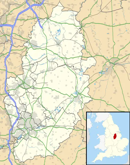
 Moorhouse Location within Nottinghamshire | |
| Population | 251 (2021) including Laxton |
| OS grid reference | SK 75278 66604 |
| Civil parish | |
| District | |
| Shire county | |
| Region | |
| Country | England |
| Sovereign state | United Kingdom |
| Post town | NEWARK |
| Postcode district | NG23 |
| Police | Nottinghamshire |
| Fire | Nottinghamshire |
| Ambulance | East Midlands |
| UK Parliament | |
| Website | www.laxtonandmoorhouse |
Moorhouse or Laxton Moorhouse is a hamlet within the Laxton and Moorhouse parish, in the Newark and Sherwood district of central Nottinghamshire, England.
Toponymy
The name Moorhouse was a local name meaning the inhabitant at the house on the moorland. Known as Morhus by 1231, it derived from elements of the Old English words mor, meaning marsh or fen, and hus, meaning house. Later interpretations included Morhuses in 1232, and through local association Laxton (or Lexington) Morehouse by 1324.[1]
Geography
The area is 2 miles east of Laxton, and 20 miles northeast of Nottingham. Predominantly, it is a scattering of farms, farmhouses and cottages amongst a wider rural setting. These are grouped around three roads meeting by a single junction: Green Lane, Moorhouse Lane, and Ossington Lane.
In the Census 2021 reports, the population of the wider parish of Laxton and Moorhouse was 251.[2][3]
The Moorhouse Beck stream runs through the village, rising from several locations in the south of the parish.
The village lays in a shallow valley, at 84 feet (26 m) with the surrounding land higher except towards the east.
The nearest forested feature is East Park Wood, around 1 kilometre (0.62 mi) northwest of the village.
History
The Moorhouse area changed hands several times throughout the years, William The Conqueror granting the manor first to Geoffrey Alselin in 1066.[4] Sir William Courten was a later owner who commissioned a survey of the Laxton and Moorhouse lands, with cartographer Mark Pierce drafting for him a well-regarded 1635 map demonstrating extensive use of the open field system.[5] Moorhouse was partially within an 'East Field' and mainly located within the 'North Field', with some of those inhabitants also farming the South Field at Laxton.
The fields around Moorhouse were eventually enclosed from 1860 through the Moorhouse Enclosure Act,[6] with much of the property under the John Denison Ossington Estate by the turn of the 20th century. The ownership of the rest was shared with the Earl of Scarborough, and Earl Manvers Pierrepont family notably on Church Farm[7][8][9] until 1950 when the 6th Earl sold it to their tenants. Most of the Laxton manor was sold to the Ministry of Agriculture in 1952,[10] with a further sale to the Crown Estate in 1981,[11] it was sold back to the Earl Manvers Thoresby Estate in 2020.[12]
As well as the Moorhouse chapel, there was also a small Methodist chapel which has been unused as such in recent times.[13]
In 1990, the Laxton parish name was changed to include Moorhouse.[14]
Economy
Farming is the key industry with much of the available land and buildings used to support this activity.
There is a bed and breakfast facility at a 17th-century cottage within the village.[15]
Metal fabrication services are also provided for locally.[16]
Landmarks
Moorhouse Chapel
The Moorhouse Chantry Chapel is a key feature in the area, just north east of the road junction. It is dedicated to St. Nicholas, and was erected in 1861 using a Gothic style, by John Evelyn Denison of nearby Ossington Hall who was a local landowner.[17] It is believed that there was an original chapel on the same site built for the private use of Robert de Lexington early in the thirteenth century, with the bell being reused in the replacement church.[13]
Listed buildings
As well as the church (Grade II*),[18] there are two other listed buildings (Grade II) within the village:
References
- ↑ "Moorhouse :: Survey of English Place-Names". epns.nottingham.ac.uk. Retrieved 23 November 2020.
- ↑ UK Census (2021). "2021 Census Area Profile – Laxton and Moorhouse parish (E04007923)". Nomis. Office for National Statistics. Retrieved 12 January 2024.
- ↑ "Custom report - Nomis - Official Labour Market Statistics". www.nomisweb.co.uk. Retrieved 9 November 2020.
- ↑ "Laxton and Morehouse | British History Online". www.british-history.ac.uk. Retrieved 9 November 2020.
- ↑ "Mark Pierce's Map - The University of Nottingham". www.nottingham.ac.uk. Retrieved 9 November 2020.
- ↑ "Enclosing Laxton - The University of Nottingham". www.nottingham.ac.uk. Retrieved 9 November 2020.
- ↑ "Manvers Estate Map - The University of Nottingham". www.nottingham.ac.uk. Retrieved 9 November 2020.
- ↑ "Landscape History" (PDF).
- ↑ GENUKI. "Genuki: White's Directory of Nottinghamshire, 1853, Nottinghamshire". www.genuki.org.uk. Retrieved 10 November 2020.
- ↑ "Enclosure - The University of Nottingham". www.nottingham.ac.uk. Retrieved 9 November 2020.
- ↑ "Timeline - The University of Nottingham". www.nottingham.ac.uk. Retrieved 9 November 2020.
- ↑ "Laxton looks to future with new owner and hall". Newark Advertiser. 14 February 2020. Retrieved 9 November 2020.
- 1 2 "VILLAGE BUILDINGS - A Snapshot in Time: Laxton in Peace and War, 1900–1920" (PDF).
- ↑ "LGBCE | Nottinghamshire | LGBCE Site". www.lgbce.org.uk. Retrieved 10 November 2020.
- ↑ "Brecks Cottage Bed and Breakfast | Brecks Cottage, Green Lane, Moorhouse, Newark, Notts.., Sherwood Forest, NG23 6LZ". Hotels & BB's. Retrieved 9 November 2020.
- ↑ "Contact us". www.alloyracingfabrications.com. Retrieved 9 November 2020.
- ↑ "St Nicholas Chapel ::: St. Nicholas Center". www.stnicholascenter.org. Retrieved 9 November 2020.
- ↑ "MOORHOUSE CHAPEL, Laxton and Moorhouse - 1045631 | Historic England". historicengland.org.uk. Retrieved 9 November 2020.
- ↑ "CHURCH FARMHOUSE, Laxton and Moorhouse - 1045632 | Historic England". historicengland.org.uk. Retrieved 9 November 2020.
- ↑ "AGGRIE HOUSE, Laxton and Moorhouse - 1302636 | Historic England". historicengland.org.uk. Retrieved 9 November 2020.