| Mother Cummings Peak | |
|---|---|
 | |
| Highest point | |
| Elevation | 1,255 m (4,117 ft)[1] |
| Prominence | 180 m (590 ft)[1] |
| Parent peak | Ironstone Mountain |
| Isolation | 11.89 km (7.39 mi)[1] |
| Listing | Highest mountains of Tasmania |
| Coordinates | 41°40′39″S 146°32′37″E / 41.67750°S 146.54361°E |
| Geography | |
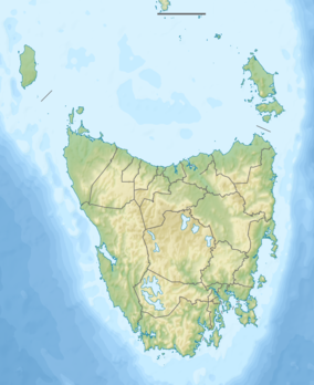
 Mother Cummings Peak Location in Tasmania | |
| Country | Australia |
| State | Tasmania |
| Region | Central Highlands |
| Range coordinates | 41°55′48″S 147°10′12″E / 41.93000°S 147.17000°E[2] |
| Parent range | Great Western Tiers |
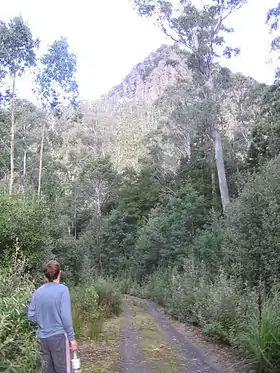
The Mother Cummings Peak is one of the prominent peaks on the Great Western Tiers located in the Central Highlands region of Tasmania, Australia.
With an estimated elevation of between 1,260 and 1,270 metres (4,134 and 4,167 ft) above sea level,[1][3] the summit of Cummings Head offers 360 degree views. The summit can be reached in about 1 – 2 hours (depending on fitness), and the track is rather steep. Two walking tracks lead to the summit: one from the north via Mole Creek, and the other from the south from the upper Meander Valley.
See also
References
- 1 2 3 4 "Cummings Head, Australia". Peakbagger.com. Retrieved 31 May 2017.
- ↑ "Great Western Tiers (TAS)". Gazetteer of Australia online. Geoscience Australia, Australian Government.
- ↑ "LISTmap (Mother Cummings Peak)". Tasmanian Government Department of Primary Industries and Water. Retrieved 29 February 2008.
This article is issued from Wikipedia. The text is licensed under Creative Commons - Attribution - Sharealike. Additional terms may apply for the media files.
