

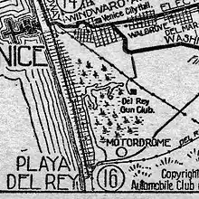
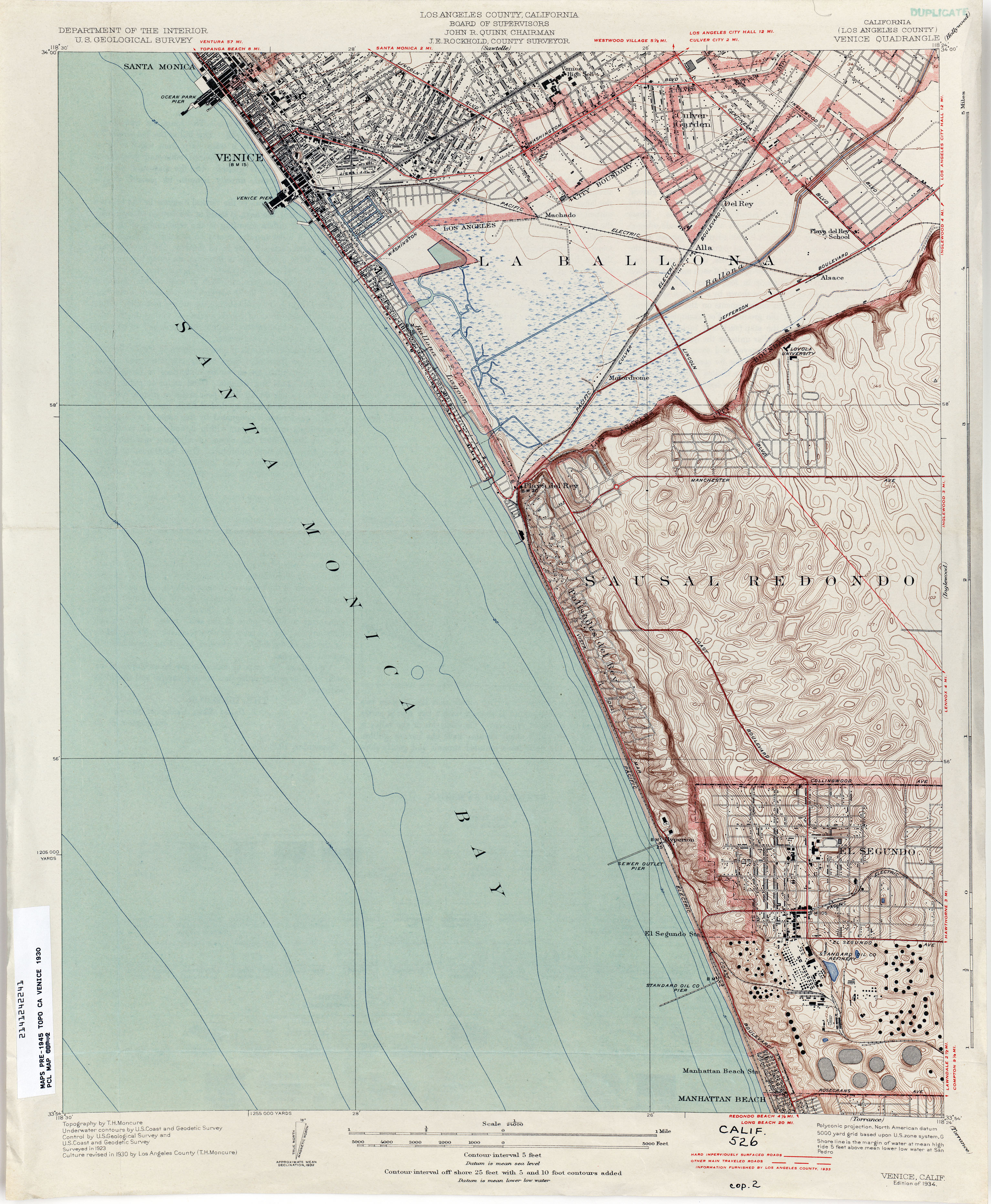
.jpg.webp)
Motordrome is an archaic placename in Los Angeles County, California.[1] It designates a rail spur that existed in the 1910s[2] on the Redondo Beach via Del Rey Line, named for the Los Angeles Motordrome race track and airfield.[3] Motordrome station lay at an elevation of 7 feet (2 m).[1] The coordinates for Motordrome preserved in the GNIS (33°58′07″N 118°26′21″W / 33.96861°N 118.43917°W) place it near the present-day intersections of Jefferson Boulevard and Culver Boulevard, in what is now the Ballona Wetlands Ecological Reserve.
Even though the racetrack was destroyed in a fire in 1913, and the rails were removed by 1918,[2] the place name persisted on USGS survey maps until at least the 1930s.[4]
The Barnes Circus train partially derailed at Motordrome in 1914, injuring four.[5]
See also
References
- 1 2 U.S. Geological Survey Geographic Names Information System: Motordrome, California
- 1 2 Crosse, John (2011-03-12). "Southern California Architectural History: Playa del Rey: Speed Capital of the World, The Los(t) Angeles Motordrome, 1910-1913". Southern California Architectural History. Archived from the original on 2021-08-05. Retrieved 2022-10-15.
- ↑ KINNEY, JEREMY R. “Sports Car Paradise: Racing in Los Angeles.” LA Sports: Play, Games, and Community in the City of Angels, edited by Wayne Wilson and David K. Wiggins, University of Arkansas Press, 2018, pp. 93–108. JSTOR, doi:10.2307/j.ctt1x76cvb.10. Accessed 25 Sep. 2022.
- ↑ "Venice (Los Angeles County) 1930 1:24,000 (3.2MB)". Perry-Castañeda Library Map Collection - California Topographic Maps. Archived from the original on 2022-09-25. Retrieved 2022-09-25.
- ↑ "Los Angeles Herald 28 November 1914 — California Digital Newspaper Collection". cdnc.ucr.edu. Retrieved 2022-10-25.
External links