| Mount Egon | |
|---|---|
 | |
| Highest point | |
| Elevation | 1,661 m (5,449 ft)[1] |
| Listing | Ribu |
| Coordinates | 08°40′S 122°27′E / 8.667°S 122.450°E[1] |
| Geography | |
 Mount Egon | |
| Geology | |
| Mountain type | Stratovolcano |
| Last eruption | April 2008[1] |
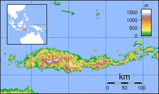
Mount Egon (Gunung Egon, sometimes also called Gunung Namang) is a stratovolcano located in the southeastern part of the island of Flores, Indonesia in the area of Maumere bay. A landslide during the eruption on 29 January 2004 forced 6,000 people to evacuate the area. Activity of Gunung Egon on 15 April 2008 forced thousands of people to evacuate.[2] Quakes and fumes from the volcano have been occurring since November 2010, designating Egon as one of 11 volcanoes in Indonesia on the highest level alert.[3]
See also
References
- 1 2 3 "Egon". Global Volcanism Program. Smithsonian Institution. Retrieved 2006-08-15.
- ↑ sunda-islands.com/Malaysia Discovery Encyclopedia Article on Gunung Egon
- ↑ "Mount Egon increases volcanic activity". The Jakarta Post. November 4, 2010. Archived from the original on January 6, 2011. Retrieved 2011-01-10.
This article is issued from Wikipedia. The text is licensed under Creative Commons - Attribution - Sharealike. Additional terms may apply for the media files.