| Mount La Crosse | |
|---|---|
 | |
| Highest point | |
| Elevation | 6,417 ft (1,956 m)[1] |
| Prominence | 977 ft (298 m)[1] |
| Coordinates | 47°41′05″N 123°18′44″W / 47.684773°N 123.312194°W[1] |
| Geography | |
 Mount La Crosse Location of Mount La Crosse in Washington  Mount La Crosse Mount La Crosse (the United States) | |
| Location | Jefferson County, Washington, United States |
| Parent range | Olympic Mountains |
| Topo map | USGS Mount Steel |
| Geology | |
| Age of rock | Eocene |
| Type of rock | Basalt[2] |
| Climbing | |
| First ascent | 1928 Richard Paulson, William Ryer, Paul Wiseman, Frank Woodworth |
| Easiest route | Scrambling Class 2 [3] |
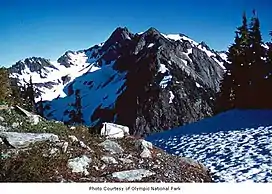
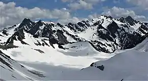
Mount La Crosse, is a 6,417-foot (1,956-metre) mountain summit in the Olympic Mountains and is located in Jefferson County of Washington state. It is situated in Olympic National Park and its nearest higher peak is Mount Elk Lick, 2.54 mi (4.09 km) to the east.[1] The Anderson massif lies 2.67 mi (4.30 km) to the north of Mount La Crosse, and White Mountain lies 0.95 mi (1.53 km) to the southwest.
History
The peak's name derives from the nearby lake with the same name, Lake La Crosse. Members of the 1890 O'Neil Expedition named the body of water "Lake of the Holy Cross" because of a large tree with branches and trunk in the shape of a cross guarded the lake. Over the subsequent years the name transformed to "Lake of the Cross" and eventually to its present-day name.[4] It is also spelled as Mount LaCrosse.[5]
The first ascent of the mountain was made in 1928 by Richard Paulson, William Ryer, Paul Wiseman, and Frank Woodworth.[6]
Climate

Based on the Köppen climate classification, Mount La Crosse is located in the marine west coast climate zone of western North America.[7] Most weather fronts originate in the Pacific Ocean, and travel northeast toward the Olympic Mountains. As fronts approach, they are forced upward by the peaks of the Olympic Range, causing them to drop their moisture in the form of rain or snowfall (Orographic lift). As a result, the Olympics experience high precipitation, especially during the winter months. During winter months, weather is usually cloudy, but, due to high pressure systems over the Pacific Ocean that intensify during summer months, there is often little or no cloud cover during the summer. In terms of favorable weather, June to September are the best months for climbing the mountain. Precipitation runoff from the mountain drains into tributaries of the Dosewallips River and Duckabush River.
See also
References
- 1 2 3 4 "Mount La Crosse". Peakbagger.com.
- ↑ Parks geomaps
- ↑ Mount La Crosse on Climbersguideolympics.com
- ↑ Parratt, Smitty (1984). Gods and Goblins: A Field Guide to Place Names of Olympic National Park (1st ed.).
- ↑ "Mount LaCrosse". Geographic Names Information System. United States Geological Survey, United States Department of the Interior. Retrieved January 27, 2019.
- ↑ Olympic Mountains: A Climbing Guide, Olympic Mountain Rescue, Fourth Edition, 2006, The Mountaineers Books, page 103
- ↑ Peel, M. C.; Finlayson, B. L.; McMahon, T. A. (2007). "Updated world map of the Köppen−Geiger climate classification". Hydrol. Earth Syst. Sci. 11 (5): 1633. Bibcode:2007HESS...11.1633P. doi:10.5194/hess-11-1633-2007. ISSN 1027-5606. S2CID 9654551.
External links
- "Olympic National Park". National Park Service.
- Mount La Crosse weather: Mountain Forecast