| Meliau Hill | |
|---|---|
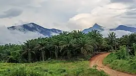
 Meliau Hill taken from Buis Kiabau Road, Telupid | |
| Highest point | |
| Elevation | 1,321 m (4,334 ft) |
| Prominence | 888 m (2,913 ft) |
| Listing | Ribu |
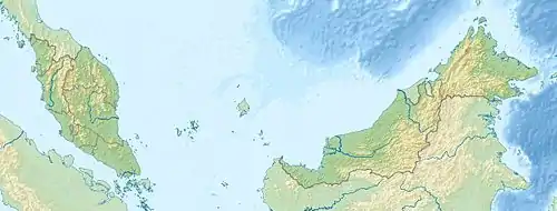
| Coordinates | 5°50′10″N 117°01′35″E / 5.836111°N 117.026389°E |
| Geography | |
 Meliau Hill | |
| Parent range | Crocker Range |
Meliau Hill (Malay: Bukit Meliau) is a mountain located on the north bank the Labuk River between Telupid and Pamol in the eastern part of Ulu Tungud Forest Reserve in Telupid District, Sabah, Malaysia. The summit is 1,321 m above sea level.[1] [2]
References
- ↑ "Bukit Meliau, Malaysia". peakvisor. Retrieved 2021-06-11.
- ↑ "Meliau Range". GEC. Retrieved 2021-06-11.
This article is issued from Wikipedia. The text is licensed under Creative Commons - Attribution - Sharealike. Additional terms may apply for the media files.