| Mount Rockwell | |
|---|---|
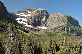 Northeast aspect | |
| Highest point | |
| Elevation | 9,277 ft (2,828 m)[1] |
| Prominence | 2,192 ft (668 m)[1] |
| Coordinates | 48°26′36″N 113°27′04″W / 48.44333°N 113.45111°W[2] |
| Geography | |
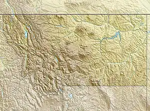 Mount Rockwell Location in Montana  Mount Rockwell Location in the United States | |
| Location | Flathead County, Montana, Glacier County, Montana, U.S. |
| Parent range | Lewis Range |
| Topo map | USGS Mount Rockwell, MT |
Mount Rockwell (9,277 feet (2,828 m)) is located in the Lewis Range, Glacier National Park in the U.S. state of Montana.[1][3] Mount Rockwell is situated along the Continental Divide and Aurice Lake is just west of the peak.
See also
References
- 1 2 3 "Mount Rockwell, Montana". Peakbagger.com. Retrieved December 26, 2018.
- ↑ "Mount Rockwell". Geographic Names Information System. United States Geological Survey, United States Department of the Interior. Retrieved December 26, 2018.
- ↑ Mount Rockwell, MT (Map). TopoQwest (United States Geological Survey Maps). Retrieved December 26, 2018.
.jpg.webp)
Southeast aspect
This article is issued from Wikipedia. The text is licensed under Creative Commons - Attribution - Sharealike. Additional terms may apply for the media files.