Mueang Khon Kaen
เมืองขอนแก่น | |
|---|---|
 Aerial view of the district | |
| Motto(s): รักษาประเพณี พัฒนาท้องที่
สร้างสามัคคีในสังคม นิยมประหยัด Protect culture, Upgrade local, build Unity in Society, admire conserve. | |
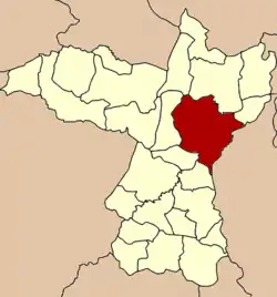 District location in Khon Kaen province | |
| Coordinates: 16°26′18″N 102°50′20″E / 16.43833°N 102.83889°E | |
| Country | Thailand |
| Province | Khon Kaen |
| Seat | Nai Mueang |
| Area | |
| • Total | 953.4 km2 (368.1 sq mi) |
| Population (2022) | |
| • Total | 412,758 |
| • Density | 432.93/km2 (1,121.3/sq mi) |
| Time zone | UTC+7 (ICT) |
| Postal code | 40000 |
| Geocode | 4001 |
Mueang Khon Kaen (Thai: เมืองขอนแก่น, pronounced [mɯ̄a̯ŋ kʰɔ̌(ː)n kɛ̀n]) is the capital district (amphoe mueang) of Khon Kaen province, northeastern Thailand.
Geography
Neighboring districts are (from the south clockwise) Ban Haet, Phra Yuen, Ban Fang, Ubolratana, Nam Phong, and Sam Sung of Khon Kaen Province; Kosum Phisai and Chiang Yuen of Maha Sarakham province.
History
On 29 April 1917, the district name was changed from Mueang to Phra Lap (พระลับ).[1] On 14 November 1937 it was renamed Mueang Khon Kaen.[2]
Administration
The district is divided into 17 sub-districts (tambons), which are further subdivided into 272 villages (mubans). The city (thesaban nakhon) Khon Kaen covers the whole tambon Nai Mueang. Tha Phra is a sub-district municipality (thesaban tambon) covering parts of tambon Tha Phra. There are a further 16 tambon administrative organizations (TAO).
| No. | Name | Thai | Villages | Pop. (2008)[3] |
|---|---|---|---|---|
| 1. | Nai Muang | ในเมือง | - | 118,203 |
| 2. | Samran | สำราญ | 13 | 9,637 |
| 3. | Khok Si | โคกสี | 14 | 8,788 |
| 4. | Tha Phra | ท่าพระ | 20 | 19,197 |
| 5. | Ban Thum | บ้านทุ่ม | 17 | 17,088 |
| 6. | Mueang Kao | เมืองเก่า | 17 | 24,840 |
| 7. | Phra Lap | พระลับ | 19 | 20,803 |
| 8. | Sawathi | สาวะถี | 23 | 17,751 |
| 9. | Ban Wa | บ้านหว้า | 13 | 10,632 |
| 10. | Ban Kho | บ้านค้อ | 19 | 15,352 |
| 11. | Daeng Yai | แดงใหญ่ | 10 | 7,190 |
| 12. | Don Chang | ดอนช้าง | 8 | 4,745 |
| 13. | Don Han | ดอนหัน | 15 | 9,812 |
| 14. | Sila | ศิลา | 28 | 44,194 |
| 15. | Ban Pet | บ้านเป็ด | 23 | 29,801 |
| 16. | Nong Tum | หนองตูม | 11 | 7,375 |
| 17. | Bueng Niam | บึงเนียม | 12 | 7,291 |
| 18. | Non Thon | โนนท่อน | 10 | 9,457 |
References
- ↑ "ประกาศเรื่องเปลียนชืออำเภอ" [Notice of changing district name] (PDF). Royal Thai Government Gazette. 34: 40–68. 29 April 1917. Archived from the original (PDF) on 7 November 2011. Retrieved 15 November 2019, page 60
{{cite journal}}: CS1 maint: postscript (link) - ↑ "พระราชกฤษฎีกา เปลี่ยนนามจังหวัด และอำเภอบางแห่ง พุทธศักราช ๒๔๘๑" [Royal Decree: Change name of Provinces and Districts] (PDF). Royal Thai Government Gazette. 55: 658–666. 14 November 1938. Archived from the original (PDF) on 8 November 2011. Retrieved 20 April 2020, page 659
{{cite journal}}: CS1 maint: postscript (link) - ↑ "Population statistics 2008". Department of Provincial Administration. Archived from the original on 4 June 2009. Retrieved 10 November 2009.
External links
- amphoe.com (Thai)