Muránska Dlhá Lúka | |
|---|---|
Municipality | |
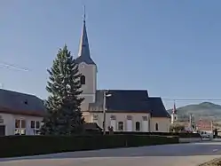 Church | |
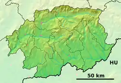 Muránska Dlhá Lúka Location of Muránska Dlhá Lúka in the Banská Bystrica Region 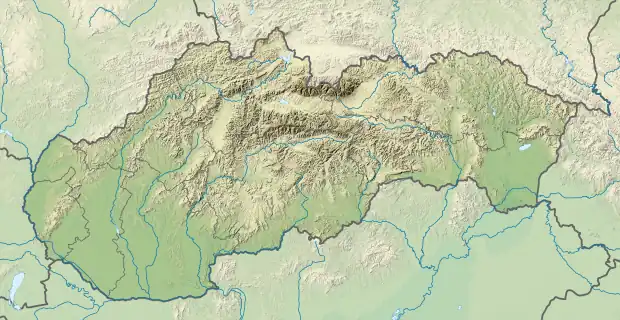 Muránska Dlhá Lúka Location of Muránska Dlhá Lúka in Slovakia | |
| Coordinates: 48°43′00″N 20°05′00″E / 48.71667°N 20.08333°E | |
| Country | |
| Region | Banská Bystrica |
| District | Revúca |
| First mentioned | 1357 |
| Government | |
| • Mayor | Ing.Marek Nosko |
| Area | |
| • Total | 18.65[1] km2 (7.20[1] sq mi) |
| Elevation | 343[2] m (1,125[2] ft) |
| Population (2021) | |
| • Total | 920[3] |
| Time zone | UTC+1 (CET) |
| • Summer (DST) | UTC+2 (CEST) |
| Postal code | 049 19[2] |
| Area code | +421 58[2] |
| Car plate | RA |
| Website | www |
Muránska Dlhá Lúka (Hungarian: Murányhosszúrét) is a village and municipality in Revúca District in the Banská Bystrica Region of Slovakia.[4]
References
- 1 2 "Hustota obyvateľstva - obce [om7014rr_ukaz: Rozloha (Štvorcový meter)]". www.statistics.sk (in Slovak). Statistical Office of the Slovak Republic. 2022-03-31. Retrieved 2022-03-31.
- 1 2 3 4 "Základná charakteristika". www.statistics.sk (in Slovak). Statistical Office of the Slovak Republic. 2015-04-17. Retrieved 2022-03-31.
- ↑ "Počet obyvateľov podľa pohlavia - obce (ročne)". www.statistics.sk (in Slovak). Statistical Office of the Slovak Republic. 2022-03-31. Retrieved 2022-03-31.
- ↑ "Statistical Office of the Slovak Republic" (PDF). Výsledky SODB 2011. Štatistický úrad SR. Retrieved 9 August 2012.
External links
 Media related to Muránska Dlhá Lúka at Wikimedia Commons
- Official website

- https://web.archive.org/web/20160731080853/http://muranskadlhaluka.e-obce.sk/
This article is issued from Wikipedia. The text is licensed under Creative Commons - Attribution - Sharealike. Additional terms may apply for the media files.