Muscotah, Kansas | |
|---|---|
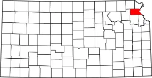
 Location within Atchison County and Kansas | |
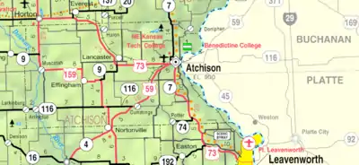
 KDOT map of Atchison County (legend) | |
| Coordinates: 39°33′13″N 95°31′14″W / 39.55361°N 95.52056°W[1] | |
| Country | United States |
| State | Kansas |
| County | Atchison |
| Township | Grasshopper |
| Platted | 1857 |
| Government | |
| • Type | Mayor–Council |
| • Mayor | Brian Higley[2] |
| Area | |
| • Total | 0.33 sq mi (0.86 km2) |
| • Land | 0.33 sq mi (0.86 km2) |
| • Water | 0.00 sq mi (0.00 km2) |
| Elevation | 1,014 ft (309 m) |
| Population | |
| • Total | 155 |
| • Density | 470/sq mi (180/km2) |
| Time zone | UTC−6 (CST) |
| • Summer (DST) | UTC−5 (CDT) |
| ZIP Code | 66058 |
| Area code | 785 |
| FIPS code | 20-49325 |
| GNIS ID | 2395144[1] |
Muscotah is a city in Atchison County, Kansas, United States.[1] As of the 2020 census, the population of the city was 155.[4] Muscotah was named for the Kickapoo Native American word for "prairie"[5]
History
Muscotah was platted in 1857.[6] The original location of the town was about two and a half miles northeast of the current location of the town. Soon after the town was founded in its original location, it was determined that the Central Branch Union Pacific Railroad line would pass just to the south, so a new town was built on the railroad line near the Delaware River. A grist mill was built on the river to take advantage of the water power.
Geography
According to the United States Census Bureau, the city has a total area of 0.34 square miles (0.88 km2), all of it land.[7]
Demographics
| Census | Pop. | Note | %± |
|---|---|---|---|
| 1880 | 412 | — | |
| 1890 | 524 | 27.2% | |
| 1900 | 462 | −11.8% | |
| 1910 | 491 | 6.3% | |
| 1920 | 427 | −13.0% | |
| 1930 | 366 | −14.3% | |
| 1940 | 331 | −9.6% | |
| 1950 | 248 | −25.1% | |
| 1960 | 228 | −8.1% | |
| 1970 | 206 | −9.6% | |
| 1980 | 248 | 20.4% | |
| 1990 | 194 | −21.8% | |
| 2000 | 200 | 3.1% | |
| 2010 | 176 | −12.0% | |
| 2020 | 155 | −11.9% | |
| U.S. Decennial Census | |||
2020 census
The 2020 United States census counted 155 people, 58 households, and 40 families in Muscotah.[8][9] The population density was 465.5 per square mile (179.7/km2). There were 72 housing units at an average density of 216.2 per square mile (83.5/km2).[9][10] The racial makeup was 92.26% (143) white or European American (92.26% non-Hispanic white), 0.0% (0) black or African-American, 0.65% (1) Native American or Alaska Native, 0.0% (0) Asian, 0.0% (0) Pacific Islander or Native Hawaiian, 3.23% (5) from other races, and 3.87% (6) from two or more races.[11] Hispanic or Latino of any race was 1.94% (3) of the population.[12]
Of the 58 households, 36.2% had children under the age of 18; 51.7% were married couples living together; 19.0% had a female householder with no spouse or partner present. 25.9% of households consisted of individuals and 10.3% had someone living alone who was 65 years of age or older.[9] The average household size was 2.0 and the average family size was 2.7.[13] The percent of those with a bachelor’s degree or higher was estimated to be 6.5% of the population.[14]
28.4% of the population was under the age of 18, 2.6% from 18 to 24, 12.3% from 25 to 44, 37.4% from 45 to 64, and 19.4% who were 65 years of age or older. The median age was 50.4 years. For every 100 females, there were 74.2 males.[9] For every 100 females ages 18 and older, there were 73.4 males.[9]
The 2016-2020 5-year American Community Survey estimates show that the median household income was $51,250 (with a margin of error of +/- $32,412) and the median family income was $68,500 (+/- $6,702).[15] Males had a median income of $32,750 (+/- $7,905) versus $28,056 (+/- $2,704) for females. The median income for those above 16 years old was $30,694 (+/- $2,639).[16] Approximately, 6.5% of families and 7.5% of the population were below the poverty line, including 0.0% of those under the age of 18 and 8.1% of those ages 65 or over.[17][18]
2010 census
As of the census[19] of 2010, there were 176 people, 69 households, and 46 families residing in the city. The population density was 517.6 inhabitants per square mile (199.8/km2). There were 90 housing units at an average density of 264.7 per square mile (102.2/km2). The racial makeup of the city was 99.4% White and 0.6% from two or more races. Hispanic or Latino of any race were 3.4% of the population.
There were 69 households, of which 31.9% had children under the age of 18 living with them, 44.9% were married couples living together, 13.0% had a female householder with no husband present, 8.7% had a male householder with no wife present, and 33.3% were non-families. 27.5% of all households were made up of individuals, and 11.6% had someone living alone who was 65 years of age or older. The average household size was 2.55 and the average family size was 3.11.
The median age in the city was 36.3 years. 26.7% of residents were under the age of 18; 5.7% were between the ages of 18 and 24; 28.4% were from 25 to 44; 23.3% were from 45 to 64; and 15.9% were 65 years of age or older. The gender makeup of the city was 52.3% male and 47.7% female.
2000 census
As of the census[20] of 2000, there were 200 people, 81 households, and 58 families residing in the city. The population density was 596.4 inhabitants per square mile (230.3/km2). There were 90 housing units at an average density of 268.4 per square mile (103.6/km2). The racial makeup of the city was 96.00% White, 2.00% Native American, and 2.00% from two or more races. Hispanic or Latino of any race were 1.00% of the population.
There were 81 households, out of which 29.6% had children under the age of 18 living with them, 59.3% were married couples living together, 3.7% had a female householder with no husband present, and 27.2% were non-families. 22.2% of all households were made up of individuals, and 13.6% had someone living alone who was 65 years of age or older. The average household size was 2.47 and the average family size was 2.88.
In the city, the population was spread out, with 25.0% under the age of 18, 8.0% from 18 to 24, 26.5% from 25 to 44, 20.0% from 45 to 64, and 20.5% who were 65 years of age or older. The median age was 36 years. For every 100 females, there were 92.3 males. For every 100 females age 18 and over, there were 100.0 males.
The median income for a household in the city was $30,833, and the median income for a family was $31,875. Males had a median income of $23,750 versus $25,625 for females. The per capita income for the city was $15,299. About 7.3% of families and 14.4% of the population were below the poverty line, including 15.7% of those under the age of eighteen and 18.9% of those 65 or over.
Government
The Muscotah government consists of a mayor and five council members. The council meets the 2nd Monday of each month at 7PM.[2]
- City Hall, 604 Kansas Ave.
Education
Muscotah Schools operated for over 130 years. The final class of Muscotah High School graduated in 1939. It was reduced to 8th grade, then later to 6th grade. The Muscotah Grade School closed in 1990. The school mascot was the Mustangs and the colors were red and white. Muscotah students currently attend Atchison County USD 377 public schools in the city of Effingham.
Notable people
- E.K. Gaylord (1873-1974), longtime owner of The Daily Oklahoman newspaper; born on a farm near Muscotah.
- Joe Tinker (1880-1948), Major League Baseball player for the Chicago Cubs and Cincinnati Reds. Playing shortstop for the Cubs, Tinker was part of the famous trio, "Tinker to Evers to Chance." He was elected to the National Baseball Hall of Fame in 1946. A monument in the Muscotah city park honors Tinker.
See also
References
- 1 2 3 4 U.S. Geological Survey Geographic Names Information System: Muscotah, Kansas
- 1 2 Muscotah - Directory of Public Officials Archived 2011-05-05 at the Wayback Machine
- ↑ "2019 U.S. Gazetteer Files". United States Census Bureau. Retrieved July 24, 2020.
- 1 2 "Profile of Muscotah, Kansas in 2020". United States Census Bureau. Archived from the original on November 11, 2022. Retrieved November 11, 2022.
- ↑ Kansas Place-Names,John Rydjord, University of Oklahoma Press, 1972, p.434 ISBN 0-8061-0994-7
- ↑ Ingalls, Sheffield (1916). History of Atchison County, Kansas. Standard Publishing Company. pp. 107.
- ↑ "US Gazetteer files 2010". United States Census Bureau. Archived from the original on January 25, 2012. Retrieved July 6, 2012.
- ↑ "US Census Bureau, Table P16: HOUSEHOLD TYPE". data.census.gov. Retrieved January 3, 2024.
- 1 2 3 4 5 "US Census Bureau, Table DP1: PROFILE OF GENERAL POPULATION AND HOUSING CHARACTERISTICS". data.census.gov. Retrieved January 3, 2024.
- ↑ Bureau, US Census. "Gazetteer Files". Census.gov. Retrieved December 30, 2023.
- ↑ "US Census Bureau, Table P1: RACE". data.census.gov. Retrieved January 3, 2024.
- ↑ "US Census Bureau, Table P2: HISPANIC OR LATINO, AND NOT HISPANIC OR LATINO BY RACE". data.census.gov. Retrieved January 3, 2024.
- ↑ "US Census Bureau, Table S1101: HOUSEHOLDS AND FAMILIES". data.census.gov. Retrieved January 3, 2024.
- ↑ "US Census Bureau, Table S1501: EDUCATIONAL ATTAINMENT". data.census.gov. Retrieved January 3, 2024.
- ↑ "US Census Bureau, Table S1903: MEDIAN INCOME IN THE PAST 12 MONTHS (IN 2020 INFLATION-ADJUSTED DOLLARS)". data.census.gov. Retrieved January 3, 2024.
- ↑ "US Census Bureau, Table S2001: EARNINGS IN THE PAST 12 MONTHS (IN 2020 INFLATION-ADJUSTED DOLLARS)". data.census.gov. Retrieved January 3, 2024.
- ↑ "US Census Bureau, Table S1701: POVERTY STATUS IN THE PAST 12 MONTHS". data.census.gov. Retrieved January 3, 2024.
- ↑ "US Census Bureau, Table S1702: POVERTY STATUS IN THE PAST 12 MONTHS OF FAMILIES". data.census.gov. Retrieved January 3, 2024.
- ↑ "U.S. Census website". United States Census Bureau. Retrieved July 6, 2012.
- ↑ "U.S. Census website". United States Census Bureau. Retrieved January 31, 2008.
Further reading
External links
- Muscotah - Directory of Public Officials
- USD 377, local school district
- Muscotah city map, KDOT
