Mykhailivskyi Raion
Михайлівський район | |
|---|---|
 Flag  Coat of arms | |
 | |
| Coordinates: 47°13′41.24″N 35°13′3.72″E / 47.2281222°N 35.2177000°E | |
| Country | |
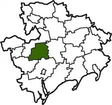
| Region | Zaporizhzhia Oblast |
| Established | 1923 |
| Disestablished | 18 July 2020 |
| Admin. center | Mykhailivka |
| Subdivisions | List
|
| Government | |
| • Governor | Sergiy Perederiy |
| Area | |
| • Total | 1,067 km2 (412 sq mi) |
| Population (2020) | |
| • Total | |
| Time zone | UTC+02:00 (EET) |
| • Summer (DST) | UTC+03:00 (EEST) |
| Postal index | 72000—72045 |
| Area code | +380 6132 |
| Website | http://mihrda.gov.ua |
Mykhailivka Raion (Ukrainian: Михайлівський район) was one of raions (districts) of Zaporizhzhia Oblast in southern Ukraine. The administrative center of the region was the urban-type settlement of Mykhailivka. The raion was abolished on 18 July 2020 as part of the administrative reform of Ukraine, which reduced the number of raions of Zaporizhzhia Oblast to five. The area of Mykhailivka Raion was merged into Vasylivka Raion.[1][2] The last estimate of the raion population was 27,862 (2020 est.)[3].
References
- ↑ "Про утворення та ліквідацію районів. Постанова Верховної Ради України № 807-ІХ". Голос України (in Ukrainian). 2020-07-18. Retrieved 2020-10-03.
- ↑ "Нові райони: карти + склад" (in Ukrainian). Міністерство розвитку громад та територій України.
- ↑ Чисельність наявного населення України на 1 січня 2020 року / Population of Ukraine Number of Existing as of January 1, 2020 (PDF) (in Ukrainian and English). Kyiv: State Statistics Service of Ukraine. Archived (PDF) from the original on 28 September 2023.
This article is issued from Wikipedia. The text is licensed under Creative Commons - Attribution - Sharealike. Additional terms may apply for the media files.