 | ||||
|---|---|---|---|---|
| Dhaka–Rangpur-Banglabandha Highway | ||||
| Route information | ||||
| Part of | ||||
| Length | 625 km[1] (388 mi) | |||
| Major junctions | ||||
| Dhaka end | N1 | |||
| Banglabandha end | Indian border | |||
| Location | ||||
| Country | Bangladesh | |||
| Highway system | ||||
| ||||
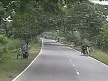
The N5 is a Bangladeshi national highway connecting the capital Dhaka, Rangpur and the town of Banglabandha on the Bangladesh-India border.[1]
Junction list
| Division | Location | km | Mile | Destinations | Notes | ||
|---|---|---|---|---|---|---|---|
| Dhaka Division | Dhaka | ||||||
| Nabinagar | R505 | ||||||
| Manikganj | R504 | ||||||
| Uthali | |||||||
| Ferry between Paturia Ferry Terminal and Kazirhat Launch Terminal | |||||||
| Rajshahi Division | Kashinathpur | ||||||
| Shahjahanpur | |||||||
| Banani | |||||||
| Jahangirabad | |||||||
| Tinmatha | |||||||
| Matidali | |||||||
| Rangpur Division | Modern Mor, Rangpur | ||||||
| Rangpur | |||||||
| Saidpur | |||||||
| Beldanga | |||||||
| Banglabandha | |||||||
References
- 1 2 "Road Master Plan" (PDF). Bangladesh Roads and Highways Department. Retrieved 12 December 2012.
This article is issued from Wikipedia. The text is licensed under Creative Commons - Attribution - Sharealike. Additional terms may apply for the media files.