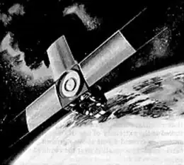
 Illustration of an ITOS series satellite | |
| Mission type | Weather |
|---|---|
| Operator | NOAA / NASA |
| COSPAR ID | 1974-089A[1] |
| SATCAT no. | 7529 |
| Mission duration | 4 years |
| Spacecraft properties | |
| Launch mass | 339.7 kilograms (749 lb) |
| Start of mission | |
| Launch date | November 15, 1974, 17:11:00 UTC[2] |
| Rocket | Delta 2310 D104 |
| Launch site | Vandenberg SLC-2W |
| End of mission | |
| Disposal | Decommissioned |
| Deactivated | November 18, 1978 |
| Orbital parameters | |
| Reference system | Geocentric |
| Regime | Sun-synchronous |
| Perigee altitude | 1,451 kilometers (902 mi) |
| Apogee altitude | 1,465 kilometers (910 mi) |
| Inclination | 101.46 degrees |
| Period | 114.91 minutes |
| Epoch | December 8, 2013, 12:44:30 UTC[3] |
| Instruments | |
| VHRR, VTPR, SR | |
ITOS | |
NOAA-4, also known as ITOS-G was a weather satellite operated by the National Oceanic and Atmospheric Administration (NOAA). It was part of a series of satellites called ITOS, or improved TIROS.[4] NOAA-4 was launched on a Delta rocket on November 15, 1974. The launch carried two other satellites: AMSAT-OSCAR 7 and Intasat.[2] It remained operational for 1463 days until it was deactivated by NOAA on November 18, 1978.
References
- ↑ "NASA/NSSDC NOAA-4 spacecraft details". Retrieved October 20, 2008.
- 1 2 McDowell, Jonathan. "Launch Log". Jonathan's Space Page. Retrieved December 8, 2013.
- ↑ "NOAA 4 Satellite details 1974-089A NORAD 7529". N2YO. December 8, 2013. Retrieved December 8, 2013.
- ↑ Wade, Mark. "ITOS". Encyclopedia Astronautica. Archived from the original on September 13, 2008. Retrieved October 20, 2008.
TIROS satellites | ||
|---|---|---|
| TIROS |  | |
| TOS | ||
| ITOS | ||
| TIROS-N | ||
| Adv. TIROS-N | ||
External links
This article is issued from Wikipedia. The text is licensed under Creative Commons - Attribution - Sharealike. Additional terms may apply for the media files.