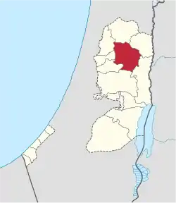
Nablus Governorate | |
|---|---|
 2018 United Nations map of the area, showing the Israeli occupation arrangements in the governorate | |
 | |
| Country | |
| Area | |
| • Total | 592 km2 (229 sq mi) |
| Population (2017)[1] | |
| • Total | 388,321 |
| This figure excludes the Israeli West Bank Settlements | |
| Governorates of the West Bank (State of Palestine) |
|---|
The Nablus Governorate (Arabic: محافظة نابلس Muḥāfaẓat Nāblus) is an administrative district of Palestine located in the Central Highlands of the West Bank, 53 km north of Jerusalem. It covers the area around the city of Nablus which serves as the muhfaza (seat) of the governorate. The governor of the district is Mahmoud Aloul.
During the first six months of the First Intifada 85 people were killed in Nablus Governorate by the Israeli army. This was the highest total of all the West Bank Governorates.[2]
Municipalities
Cities
Towns
The following localities have populations over 4,000 and municipal councils of 11-15 members.
Village councils
The following localities have populations above 1,000 and village councils of 3 to 9 members.
|
|
Refugee camps
See also
References
- ↑ "Main Indicators by Type of Locality - Population, Housing and Establishments Census 2017" (PDF). Palestinian Central Bureau of Statistics (PCBS). Retrieved 2021-01-19.
- ↑ B'Tselem information sheet July 1989. p. 4. pdf
Sources
This article is issued from Wikipedia. The text is licensed under Creative Commons - Attribution - Sharealike. Additional terms may apply for the media files.

