Nadia | |
|---|---|
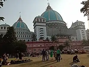
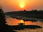
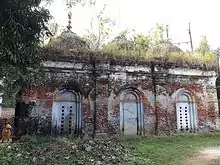
      Clockwise from top-left: Mayapur ISKCON temple, Memorial to the Bengali commanders at Palashi, Jalangi river near Palashipara, Chakdah Masjid, Banana plantation in Bhaktanagar, Somaj Bari Temple in Nabadwip | |
.svg.png.webp) Location of Nadia in West Bengal | |
| Country | |
| State | |
| Division | Presidency |
| Headquarters | Krishnanagar |
| Government | |
| • Lok Sabha constituencies | Krishnanagar, Ranaghat Some of area covered with Bangaon, North part is in Murshidabad Lok Shaba. |
| • Vidhan Sabha constituencies | Karimpur, Tehatta, Palashipara, Kaliganj, Nakashipara, Chapra, Krishnanagar Uttar, Nabadwip, Krishnanagar Dakshin, Santipur, Ranaghat Uttar Paschim, Krishnaganj, Ranaghat Uttar Purba, Ranaghat Dakshin, Chakdaha, Kalyani, Haringhata |
| Area | |
| • Total | 3,927 km2 (1,516 sq mi) |
| Population (2011) | |
| • Total | 5,167,600 |
| • Density | 1,300/km2 (3,400/sq mi) |
| • Urban | 1,438,873 |
| Demographics | |
| • Literacy | 75.58 per cent[1] |
| • Sex ratio | 947 |
| Time zone | UTC+05:30 (IST) |
| Major highways | NH 12, State Highway 8, State Highway 11, State Highway 14 |
| Website | nadia |
Nadia (pronounced [nɔd̪iːaː]) is a district in the state of West Bengal, India. It borders Bangladesh to the east, North 24 Parganas and Hooghly districts to the south, Purba Bardhaman to the west, and Murshidabad to the north.
Nadia district is highly influential in the cultural history of Bengal. The standard version of Bengali, developed in the 19th century, is based on the dialect spoken around Shantipur region of Nadia. Known as the "Oxford of Bengal", Nabadwip made many contributions to Indian philosophy, such as the Navya-Nyaya system of logic and is the birthplace of the Vaishnava saint Chaitanya Mahaprabhu.[2][3] The district is still largely agricultural.[3]
Etymology
"Nadia" is a shortened name for a historic city in the district. Nabadwip, literally "new island", was formerly an island created by alluvial deposits of the Ganga.
Geography
Nadia district is located in southern West Bengal, in the west-central Bengal region. The district is largely alluvial plain, formed by the constant shifting of the various rivers of the Ganges Delta. To the west of the district is the Bhagirathi (or Hooghly) river, which was once the main distributary of the Ganga towards the Bay of Bengal, and is still considered to be the continuation of the Ganga for Hindus. As the main flow of the Ganga flowed east into the Padma, the Bhagirathi largely dried up. Most of the rivers now flowing through Nadia now have little water in them. Nearly all the district has been converted into farmland.
Rivers
Nadia district is home to many rivers. The Padma, now the main distributary of the Ganga, touches the district on its northeastern end.
The Jalangi, which flows from Murshidabad district, forms much of the northwestern border of the district with Murshidabad, before flowing south into Nadia district. Around Krishnanagar, it turns west and flows into the Bhagirathi near Nabadwip.
The Mathabhanga originates in the far northeast of the district and forms part of the border with Bangladesh. It then flows into Bangladesh until again forming part of the border enters the district again at Gede. At Maijdia, it splits into the Churni and Ichamati. The Churni flows southwest and merges with the Bhagirathi at Shibpur near Ranaghat. The Ichamati flows into Bangladesh near Mubarakpur and reenters India near Duttaphulia. It then flows south into North 24 Parganas district.
History
Nabadwip, an ancient town within Nadia district, is often referred to as the “Oxford of Bengal".[2] Chaitanya Mahaprabhu was born in Nabadwip.[3] One of the Indian schools of logic (Tarka sastra) called Navya Nyaya system was developed in Nabadwip, which produced great logicians in the 15th century. Nabadwip was an important seat of political power and the capital of Bengal under Ballal Sen and later Lakshman Sen, kings of the Sena Empire, who ruled from 1159 to 1206.[3] In 1202, Nabadwip was captured by Bakhtiyar Khilji. This victory paved the way for Muslim rule in Bengal.[4] The British defeated Siraj ud-Daulah, Nawab of Bengal, at Palashi in this district. The 1859 revolt against European Indigo planters started from the village of Chaugacha in Krishnanagar, Nadia.[5] Nadia is thought to have had trade relations with Tibet, Nepal and Bhutan.[6]
Pre-independence Nadia had five subdivisions: Krishnagar sadar, Ranaghat, Kushtia, Meherpur and Chuadanga. Due to some cartographic error in 1947, large part of Nadia except Nabadwip initially were included into East Pakistan (now Bangladesh) due to muslim majority district in 1941census of British India. Due to protests rectification was made and on the night of August 17, 1947, Ranaghat, Krishnanagar, Shikarpur in Karimpur and Plassey were placed in India. Since then some parts of this district have been celebrating Independence day on August 17 and August 18.[7][8][9]
Governance
.svg.png.webp)
District Administration
The District of Nadia has its headquarter at Krishnanagar town. The British district of Nadia was formed in 1787. The present district of Nadia after partition was formed by Notification No.545-GA dated 23 February 1948. The District Administration is headed by the District Magistrate & District Collector, Nadia.
Administrative subdivisions
The district comprises four subdivisions: Krishnanagar Sadar, Kalyani, Ranaghat and Tehatta.[10] Krishnanagar is the district headquarters. There are 19 police stations, 2 women's and 1 cyber crime police stations, 17 community development blocks, 11 municipalities, 187 gram panchayats (3114 sets) and 2639 villages in this district.[10][11]
Other than municipality area, each subdivision contains community development blocks which in turn are divided into rural areas and census towns. In total there are 26 urban units: 9 municipalities and 15 census towns and two notified areas.[12] Ranaghat, Aistala, Satigachha, Nasra and Cooper's Camp together forms Ranaghat urban agglomeration. Nabadwip, Char Maijdia and Char Brahmanagar forms Nabadwip UA. Chakdaha, Gopalpur and Parbbatipur forms Chakdaha UA. Krishnanagar and Badkulla together forms Krishnanagar UA. Birnagar, Phulia and Taherpur together forms Birnagar UA.
Assembly constituencies
The district is divided into 17 assembly constituencies, which are part of four Lok Sabha constituencies.[13]
Demographics
| Year | Pop. | ±% p.a. |
|---|---|---|
| 1901 | 771,672 | — |
| 1911 | 774,459 | +0.04% |
| 1921 | 710,455 | −0.86% |
| 1931 | 720,944 | +0.15% |
| 1941 | 840,303 | +1.54% |
| 1951 | 1,142,686 | +3.12% |
| 1961 | 1,711,830 | +4.12% |
| 1971 | 2,223,911 | +2.65% |
| 1981 | 2,964,253 | +2.92% |
| 1991 | 3,852,097 | +2.65% |
| 2001 | 4,604,827 | +1.80% |
| 2011 | 5,167,600 | +1.16% |
| source:[14] | ||
According to the 2011 census Nadia district has a population of 5,167,600,[15] roughly equal to the US state of Colorado.[16] This gives it a ranking of 18th in India (out of a total of 640).[15] The district has a population density of 1,316 inhabitants per square kilometre (3,410/sq mi) .[15] Its population growth rate over the decade 2001-2011 was 12.24%.[15] Nadia has a sex ratio of 947 females for every 1000 males,[15] and a literacy rate of 75.58%. 27.84% of the population lives in urban areas. Scheduled Castes and Scheduled Tribes make up 29.93% and 2.72% of the population respectively.[15] Bengali is the predominant language, spoken by 98.02% of the population.[17]
Religion
| Religion | Population (1941)[19]: 75 | Percentage (1941) | Population (2011)[18] | Percentage (2011) |
|---|---|---|---|---|
| Islam |
430,704 | 51.26% | 1,382,682 | 26.76% |
| Hinduism |
392,225 | 46.68% | 3,728,482 | 72.15% |
| Tribal religion |
10,332 | 1.23% | 16,893 | 0.33% |
| Christianity |
6,632 | 0.79% | 33,835 | 0.65% |
| Others [lower-alpha 1] | 410 | 0.05% | 5,708 | 0.11% |
| Total Population | 840,303 | 100% | 5,167,600 | 100% |
As per the 2011 Census, Hinduism is the majority religion of the district, followed by 72.15% of the population. Hinduism became majority in the district after Independence, when Nadia became the destination for millions of refugees from East Pakistan, and from Bangladesh after 1971.[18]
Over 90% of Muslims live in rural areas. Muslims are majority in Karimpur II (60.38%), Kaliganj (58.51%), Nakashipara (53.06%), and Chapra (59.72%) CD blocks. Muslims are a significant minority in Tehatta II (49.89%), Krishnanagar II (42.84%), and Nabadwip (38.20%).
| CD Block | Hindu % | Muslim % | Other % |
|---|---|---|---|
| Karimpur I | 67.77 | 31.95 | 0.28 |
| Karimpur II | 39.51 | 60.38 | 0.11 |
| Tehatta I | 68.95 | 29.21 | 1.84 |
| Tehatta II | 50.00 | 49.89 | 0.11 |
| Kaliganj | 41.36 | 58.51 | 0.13 |
| Nakashipara | 46.53 | 53.06 | 0.41 |
| Chapra | 37.15 | 59.72 | 3.13 |
| Krishnanagar I | 82.78 | 15.25 | 0.14 |
| Krishnanagar II | 57.02 | 42.84 | 0.41 |
| Nabadwip | 61.39 | 38.20 | 1.97 |
| Krishnaganj | 93.98 | 5.86 | 0.16 |
| Hanskhali | 87.98 | 11.39 | 0.63 |
| Santipur | 86.45 | 11.85 | 1.7 |
| Ranaghat I | 93.82 | 5.67 | 0.51 |
| Ranaghat II | 85.65 | 12.59 | 1.76 |
| Chakdaha | 83.66 | 14.65 | 1.69 |
| Haringhata | 71.09 | 28.19 | 0.72 |
| Area not under any sub-district | 93.32 | 5.50 | 1.18 |
Flora and fauna
In 1980, Nadia district became home to the Bethuadahari Wildlife Sanctuary, which has an area of 0.7 km2 (0.3 sq mi).[20]
Education
University
- Bidhan Chandra Krishi Viswavidyalaya
- Kalyani University
- Indian Institute of Science Education and Research, Kolkata
- Maulana Abul Kalam Azad University of Technology
- West Bengal University of Animal and Fishery Sciences
- All India Institute of Medical Sciences, Kalyani
- National Institute of Biomedical Genomics
College
- Tehatta Government College, Tehatta
- Kaliganj Government College, Debagram
- Karimpur Pannadevi College, Karimpur
- Srikrishna College, Bagula
- Sudhiranjan Lahiri Mahavidyalaya, Majhdia
- Santipur College, Santipur
- Indian Institute of Handloom Technology, Fulia
- Industrial Training Institute, Fulia
- Ranaghat College, Ranaghat
- Ranaghat Government Polytechnic, Ranaghat
- Nabadwip Vidyasagar College, Nabadwip
- Krishnagar Government College, Krishnanagar
- Krishnagar Women's College, Krishnanagar
- Haringhata Mahavidyalaya, Haringhata
- Dwijendralal College, Krishnanagar
- Dr. B.R. Ambedkar College, Betai
- Chakdaha College, Chakdaha
- Plassey College, Plassey
- Pritilata Waddedar Mahavidyalaya, Panikhali
- Bipradas Pal Chowdhury Institute of Technology, Krishnanagar
- Mirmadan Mohanlal Government Polytechnic, Plassey
- Asannagar Madan Mohan Tarkalankar College, Asannagar
- Bethuadahari College, Bethuadahri
- Chapra Bangaljhi Mahavidyalaya, Chapra
- Chapra Government College, Chapra
- Muragacha Government College, Muragachha
- Kalyani Mahavidyalaya, Kalyani
- Kalyani Government Engineering College, Kalyani
- College of Medicine & JNM Hospital, Kalyani
Private College
- JIS College of Engineering, Kalyani
- Ideal Institute of Engineering, Kalyani
Transport
Rail
- Nabadwip Dham is 65 km from Bandel, 105 km from Howrah and 112 km from Sealdah on the Bandel-Katwa-Azimganj (B.A.K Loop Line) section of Eastern Railway.[21] It has three Railway Stations as Nabadwip Dham railway station (NDAE), Bishnupriya (VSPR) of Howrah Division and Nabadwip Ghat (NDF) of Sealdah Division.
- Krishnanagar City Junction is 100 km from Sealdah on the Sealdah-Lalgola Section of Eastern Railway.
- Kalinarayanpur Junction is 78 km from Sealdah on the Sealdha-Lalgola section of Eastern Railway.
- Ranaghat Junction is 74 km from Sealdah on the Sealdah-Lalgola Section of Eastern Railway.
Notable people
- Madanmohan Tarkalankar, Bengali Renaissance, Poet
- Chaitanya Mahaprabhu, Bengali Hindu mystic, saint, proponent of Bhakti yoga and Achintya Bheda Abheda philosophy
- Rani Rashmoni, Zamindar and philanthropist
- Satyendra Nath Bose, Indian mathematician and physicist specializing in theoretical physics
- Sourindra Mohan Sircar, Indian botanist, plant physiologist
- Jagadananda Roy, Science fiction writer
- Sharat Kumar Roy, Indian American geologist, first Indian to go in an expedition to North pole
- Basanta Kumar Biswas, independence revolutionary and martyr
- Dwijendralal Ray, poet, playwright and lyricist
- Krittibas Ojha, medieval Bengali poet
- Soumitra Chatterjee, actor, dramatist
- Rakhee Gulzar, actress.
- Jhulan Goswami, cricketer
- Ramtanu Lahiri, social reformer
- Bagha Jatin, Bengali revolutionary
- Shibakali Mondal, Bengali revolutionary and social activist
- Anantahari Mitra, Bengali revolutionary
- Haripada Chattopadhyay, freedom fighter and Member of Parliament
- Bikash Roy, Indian actor and filmmaker
- Subhash Mukhopadhyay, poet
- Jagannath Majumdar, independence revolutionary and politician
- Sudhir Chakraborty, educator
- Jyotirmoyee Sikdar, athlete
- Azizul Haque (educator), advocate, diplomat
- Soma Biswas, athlete
- Ujjwal Maulik, Professor and computer scientist
- Hemanta Kumar Sarkar, philologist, author, leader of Freedom Movement
- Dr. Sudhir Chakraborty, educationist and essayist
- Mohammad Mozammel Huq, poet, journalist
- Gopal Bhar, courtier and jester
- Jatindramohan Bagchi, poet, editor
- Narayan Sanyal, writer and civil engineer
- Asim Duttaroy, a Medical Scientist
Notes
- ↑ Including Jainism, Christianity, Buddhism, Zoroastrianism, Judaism, Ad-Dharmis, or not stated
References
- ↑ "District-specific Literates and Literacy Rates, 2001". Registrar General, India, Ministry of Home Affairs. Retrieved 10 October 2010.
- 1 2 Cotton, H.E.A., Calcutta Old and New, 1909/1980, p1, General Printers and Publishers Pvt. Ltd.
- 1 2 3 4 "Tourism-Details". nadia.nic.in. Retrieved 1 July 2022.
- ↑ Tourist Department Archived 9 February 2010 at the Wayback Machine
- ↑ Bhattacharya, Subhas (July 1977). "The Indigo Revolt of Bengal". Social Scientist. 5 (60): 17. JSTOR 3516809.
- ↑ "Rich in History and Tradition Kushtia Previous Name Nadia". 13 February 2018. Retrieved 26 August 2018.
- ↑ "District-level map of Bengal indicating the Radcliffe line and the expected border according to majority religious demographics".
- ↑ "Nadia keeps a date with history | Kolkata News - Times of India". The Times of India. TNN. 19 August 2011. Retrieved 21 February 2022.
- ↑ "In West Bengal, some villages celebrate Independence Day after August 15; here's why". The Indian Express. 16 August 2019. Retrieved 21 February 2022.
- 1 2 "Directory of District, Sub division, Panchayat Samiti/ Block and Gram Panchayats in West Bengal, March 2008". West Bengal. National Informatics Centre, India. 19 March 2008. Archived from the original on 25 February 2009. Retrieved 30 November 2008.
- ↑ "District Profile". Official website of the Nadia district. Archived from the original on 17 January 2009. Retrieved 30 November 2008.
- ↑ "Population, Decadal Growth Rate, Density and General Sex Ratio by Residence and Sex, West Bengal/ District/ Sub District, 1991 and 2001". West Bengal. Directorate of census operations. Retrieved 12 November 2008.
- ↑ "Delimitation Commission Order No. 18" (PDF). Government of West Bengal. Archived from the original (PDF) on 13 August 2011. Retrieved 29 August 2009.
- ↑ Decadal Variation In Population Since 1901
- 1 2 3 4 5 6 "District Census Handbook: Nadia" (PDF). censusindia.gov.in. Registrar General and Census Commissioner of India. 2011.
- ↑ "2010 Resident Population Data". U.S. Census Bureau. Retrieved 30 September 2011.
Colorado 5,029,196
- ↑ "Table C-16 Population by Mother Tongue: West Bengal". Census of India. Registrar General and Census Commissioner of India.
- 1 2 3 "Table C-01 Population by Religion: West Bengal". censusindia.gov.in. Registrar General and Census Commissioner of India. 2011.
- ↑ "CENSUS OF INDIA, 1941 VOLUME VI BENGAL PROVINCE" (PDF). Retrieved 13 August 2022.
- ↑ Indian Ministry of Forests and Environment. "Protected areas: West Bengal". Archived from the original on 23 August 2011. Retrieved 25 September 2011.
- ↑ Eastern Railway time table.
