Native name: Japanese: 媒島 | |
|---|---|
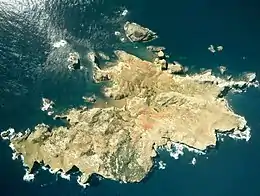
 Aerial view of Nakōdo-jima, courtesy of MLIT | |
 Nakōdo-jima | |
| Geography | |
| Location | Pacific Ocean |
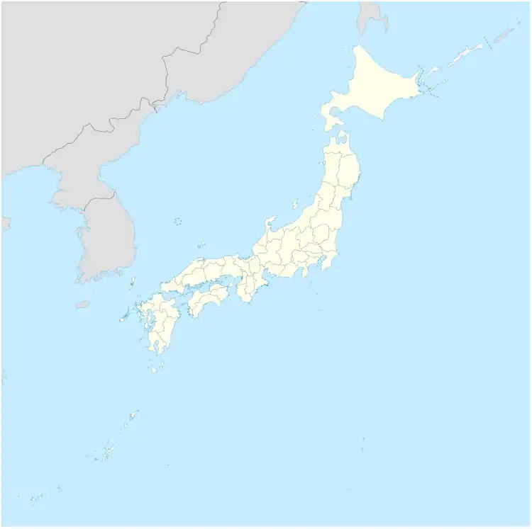
| Coordinates | 27°37′40″N 142°10′42″E / 27.62778°N 142.17833°E |
| Archipelago | Ogasawara Islands |
| Area | 1.37 km2 (0.53 sq mi)[1] |
| Highest elevation | 154.9 m (508.2 ft)[2] |
| Administration | |
Japan | |
| Prefecture | Tokyo |
| Subprefecture | Ogasawara Subprefecture |
| Village | Ogasawara |
| Demographics | |
| Population | uninhabited |
Nakōdo-jima (媒島) is an uninhabited Japanese island in the Mukojima Islands (formerly known as the Parry Group), the northernmost island group of the Bonin Islands, in the village of Ogasawara, Tokyo Metropolis. The entire island and its surrounding waters form part of Ogasawara National Park,[3] while an area of 147 hectares (360 acres) including surrounding reefs forms part of the Ogaswara Islands UNESCO World Heritage Site.[4]
Geography
The highest point on the island (and the Muko-jima Group) is Mount Byōbu (屏風山), at 154.9 metres (508 ft).[2][5]
Natural history
The island is a breeding ground for the brown booby (Sula leucogaster) and black-footed albatross (Phoebastria nigripes).[6] Vegetation, including Pandanus boninensis, Lobelia boninensis, and Cirsium boninense, has been recovering since the eradication of goats introduced when the island was inhabited between the 1880s and 1944, and feral once the island was again uninhabited.[2][6][7][8]
Related maps and images
.jpg.webp) US AMS 1945 map of the southern islands in the Mukojima Islands
US AMS 1945 map of the southern islands in the Mukojima Islands View of Nakōdo-jima from the sea
See also
References
- ↑ 全国都道府県市区町村別面積調 [National Area by Prefecture, City, Ward, Town, and Village] (PDF) (in Japanese). Geospatial Information Authority of Japan. 1 October 2020. p. 86. Retrieved 7 May 2022.
- 1 2 3 Watanabe Etsuo 渡邊悦夫 (2016). 小笠原諸島・媒島における植生復元の取り組み [Action of the vegetation reconstruction in Ogasawara Islands, Nakoudojima]. Journal of the Japan Society of Erosion Control Engineering 砂防学会誌 (in Japanese). 69 (2): 30–35. doi:10.11475/sabo.69.2_30. ISSN 0286-8385.
- ↑ 区域図 聟島、西之島、北硫黄島 [Area Map: Mukojima, Nishinoshima, North Iwojima] (PDF) (in Japanese). Ministry of the Environment. Retrieved 7 May 2022.
- ↑ "Ogaswara Islands: Maps". UNESCO. Retrieved 7 May 2022.
- ↑ "Mukojima islands". BirdLife International. Retrieved 7 May 2022.
- 1 2 "Nomination of the Ogaswara Islands for Inscription on the World Heritage List: Appendix 1 — Management Plan" (PDF). Government of Japan. January 2010. p. 77. Retrieved 7 May 2022.
- ↑ Ōsawa Takeshi 大澤剛士; Hata Kenji 畑憲治; Kachi Naoki 可知直毅 (31 May 2017). ノヤギの駆除が外来植物ギンネムの繁茂を促進する [Spread of exotic plant Leucaena leucocephala encouraged by eradication of wild goats]. Annual Report of Ogasawara Research 小笠原研究年報 (in Japanese). 40: 13–23. hdl:10748/00009723. ISSN 0387-9844.
- ↑ Suzuki Hajime 鈴木創; Horikoshi Kazuo 堀越和夫; Sasaki Tetsuro 佐々木哲朗; Kawakami Kazuto 川上和人 (2019). 小笠原諸島聟島列島におけるノヤギ排除後の海鳥営巣数の急激 な増加 [Rapid increase in seabird breeding population after feral goat eradication on Mukojima, Ogasawara Islands, Japan]. Japanese Journal of Ornithology (in Japanese and English). 68 (2): 273–287. doi:10.3838/jjo.68.273. ISSN 0913-400X.