Nancai Town
南彩镇 | |
|---|---|
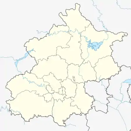
.png.webp) Location of Nancai Town within Shunyi District | |
 Nancai Town  Nancai Town | |
| Coordinates: 40°07′58″N 116°42′19″E / 40.13278°N 116.70528°E | |
| Country | China |
| Municipality | Beijing |
| District | Shunyi |
| Village-level Divisions | 1 communities 26 villages |
| Area | |
| • Total | 56.22 km2 (21.71 sq mi) |
| Elevation | 33 m (108 ft) |
| Population (2020) | |
| • Total | 73,163 |
| • Density | 1,300/km2 (3,400/sq mi) |
| Time zone | UTC+8 (China Standard) |
| Postal code | 101300 |
| Area code | 010 |
Nancai Town (simplified Chinese: 南彩镇; traditional Chinese: 南彩鎮; pinyin: Náncái Zhèn) is a town situated at the center of Shunyi District, Beijing. It is located south of Beixiaoying Town, west of Yang Town, North of Lisui and Renhe Towns, and east of Shuangfeng Subdistrict. It had 73,163 inhabitants within its borders in 2020.[1]
The town's name came from Cai Village that used to exist in the area, which was later split into north and south villages during the Yuan dynasty.[2]
History
| Time | Status | Under |
|---|---|---|
| 1912–1949 | Yuxinzhuang | Miyun County |
| Daxingzhuang | Sanhe County | |
| 1949–1958 | 7th District | Shunyi County |
| 1958–1962 | Wuli Management District, part of Yanggezhuang People's Commune | |
| 1962–1983 | Nancai People's Commune | |
| 1983–1989 | Nancai Township | |
| 1989–1998 | Nancai Town (Incorporated Fengbo Township in 1997) | |
| 1998–present | Shunyi District |
Administrative divisions
In 2021, There were 27 subdivisions within Nancai Town, consisted of 1 community and 26 villages:[3]
| Administrative Division Code | Subdisvision Names | Name Transliteration | Type |
|---|---|---|---|
| 110113106001 | 彩丰 | Caifeng | Community |
| 110113106201 | 前薛各庄 | Qian Xuegezhuang | Village |
| 110113106202 | 后薛各庄 | Hou Xuegezhuang | Village |
| 110113106203 | 南彩 | Nancai | Village |
| 110113106204 | 坞里 | Wuli | Village |
| 110113106205 | 双营 | Shuangying | Village |
| 110113106206 | 南小营 | Nan Xiaoying | Village |
| 110113106207 | 洼里 | Wali | Village |
| 110113106208 | 望渠 | Wangqu | Village |
| 110113106209 | 道仙庄 | Daoxianzhuang | Village |
| 110113106210 | 东江头 | Dong Jiangtou | Village |
| 110113106211 | 西江头 | Xi Jiangtou | Village |
| 110113106212 | 于辛庄 | Yuxinzhuang | Village |
| 110113106213 | 大兴庄 | Daxingzhuang | Village |
| 110113106214 | 太平庄 | Taipingzhuang | Village |
| 110113106215 | 水屯 | Shuitun | Village |
| 110113106216 | 九王庄 | Jiuwangzhuang | Village |
| 110113106217 | 前俸伯 | Qian Fengbo | Village |
| 110113106218 | 后俸伯 | Hou Fengbo | Village |
| 110113106219 | 河北村 | Hebeicun | Village |
| 110113106220 | 杜刘庄 | Duliuzhuang | Village |
| 110113106221 | 北彩 | Beicai | Village |
| 110113106222 | 柳行 | Liuxing | Village |
| 110113106223 | 黄家场 | Huangjiachang | Village |
| 110113106224 | 桥头 | Qiaotou | Village |
| 110113106225 | 前郝家疃 | Qian Hejiatuan | Village |
| 110113106226 | 后郝家疃 | Hou Hejiatuan | Village |
See also
References
- ↑ "北京市顺义区第七次全国人口普查公报发布". ie.bjd.com.cn (in Chinese (China)). Retrieved 2022-10-14.
- 1 2 Zhong hua ren min gong he guo zheng qu da dian. Bei jing shi juan. Li li guo, Li wan jun, Wu shi min, 李立国., 李万钧., 吴世民. Bei jing: Zhong guo she hui chu ban she. 2013. ISBN 978-7-5087-4058-4. OCLC 910451741.
{{cite book}}: CS1 maint: others (link) - ↑ "2021年统计用区划代码和城乡划分代码". www.stats.gov.cn. Retrieved 2022-10-16.
This article is issued from Wikipedia. The text is licensed under Creative Commons - Attribution - Sharealike. Additional terms may apply for the media files.