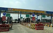
Nandigama | |
|---|---|
Town | |
Interactive map | |
.svg.png.webp) Nandigama Location in Andhra Pradesh, India  Nandigama Nandigama (India) | |
| Coordinates: 16°47′00″N 80°18′00″E / 16.7833°N 80.3000°E | |
| Country | India |
| State | Andhra Pradesh |
| District | NTR |
| Mandal | Nandigama |
| Government | |
| • Type | Municipality |
| • Chairman | Tummala Srinivas Babu |
| Area | |
| • Total | 25.90 km2 (10.00 sq mi) |
| Elevation | 21 m (69 ft) |
| Population (2011)[3] | |
| • Total | 44,359 |
| • Density | 1,700/km2 (4,400/sq mi) |
| Languages | |
| • Official | Telugu |
| Time zone | UTC+5:30 (IST) |
| PIN | 521 185 |
| Telephone code | +91–8678 |
| Vehicle registration | AP–16 |
| Vidhan Sabha constituency | Nandigama |
Nandigama is a town in NTR district of the Indian state of Andhra Pradesh. It is a Municipality and also the headquarters of Nandigama mandal in Nandigama revenue division.[2][4]
Geography
Nandigama is located 50 km West of Vijayawada and 46 km east of Kodada.
Climate
| Climate data for Nandigama (1981–2010, extremes 1989–2012) | |||||||||||||
|---|---|---|---|---|---|---|---|---|---|---|---|---|---|
| Month | Jan | Feb | Mar | Apr | May | Jun | Jul | Aug | Sep | Oct | Nov | Dec | Year |
| Record high °C (°F) | 35.8 (96.4) |
39.9 (103.8) |
42.4 (108.3) |
44.7 (112.5) |
47.1 (116.8) |
47.0 (116.6) |
40.3 (104.5) |
39.9 (103.8) |
38.2 (100.8) |
37.8 (100.0) |
34.5 (94.1) |
34.4 (93.9) |
47.1 (116.8) |
| Mean daily maximum °C (°F) | 30.9 (87.6) |
33.7 (92.7) |
36.8 (98.2) |
39.1 (102.4) |
41.1 (106.0) |
37.2 (99.0) |
33.9 (93.0) |
32.7 (90.9) |
33.0 (91.4) |
32.1 (89.8) |
31.0 (87.8) |
30.0 (86.0) |
34.3 (93.7) |
| Mean daily minimum °C (°F) | 17.0 (62.6) |
19.1 (66.4) |
21.9 (71.4) |
24.8 (76.6) |
26.7 (80.1) |
26.1 (79.0) |
24.7 (76.5) |
24.3 (75.7) |
23.9 (75.0) |
23.0 (73.4) |
19.8 (67.6) |
16.7 (62.1) |
22.3 (72.1) |
| Record low °C (°F) | 8.9 (48.0) |
13.1 (55.6) |
14.9 (58.8) |
19.1 (66.4) |
18.5 (65.3) |
19.8 (67.6) |
19.2 (66.6) |
20.4 (68.7) |
20.1 (68.2) |
15.6 (60.1) |
11.3 (52.3) |
9.8 (49.6) |
8.9 (48.0) |
| Average rainfall mm (inches) | 11.8 (0.46) |
7.7 (0.30) |
14.1 (0.56) |
13.9 (0.55) |
46.2 (1.82) |
117.0 (4.61) |
179.8 (7.08) |
225.9 (8.89) |
188.7 (7.43) |
138.3 (5.44) |
28.2 (1.11) |
10.4 (0.41) |
982.0 (38.66) |
| Average rainy days | 0.6 | 0.4 | 0.5 | 1.0 | 2.3 | 6.3 | 11.3 | 11.4 | 9.5 | 7.5 | 1.8 | 0.7 | 53.3 |
| Average relative humidity (%) (at 17:30 IST) | 49 | 44 | 39 | 39 | 36 | 49 | 62 | 68 | 70 | 71 | 64 | 56 | 54 |
| Source: India Meteorological Department[5][6] | |||||||||||||
Governance
Civic administration
Nandigama Municipality is the civic administrative body of the town which was constituted in the year 2011. It has an area of 25.90 km2 (10.00 sq mi).[1] The municipal chairman of Municipality is Padmavathi Yaragorla and the vice-chairman is V.Ashok Kumar.[7]
Politics
Nandigama a part of Nandigama (SC) (Assembly constituency) for Andhra Pradesh Legislative Assembly. It is a reserved constituency for Scheduled Castes. MONDITHOKA JAGAN MOHAN RAO is the present MLA of the constituency from YSR CONGRESS Party.[8] It is also a part of Vijayawada (Lok Sabha constituency) which was won by Kesineni Srinivas of Telugu Desam Party.[9][10]
Transport

The Andhra Pradesh State Road Transport Corporation and TSRTC operates several bus buses services from Nandigama bus station to various destinations in Andhra Pradesh and Telangana.[11] The town has a total road length of 139.60 km (86.74 mi).[12]
References
- 1 2 "Municipalities, Municipal Corporations & UDAs" (PDF). Directorate of Town and Country Planning. Government of Andhra Pradesh. Archived from the original (PDF) on 28 January 2016. Retrieved 29 January 2016.
- 1 2 "District Census Handbook - Krishna" (PDF). Census of India. p. 16,214. Retrieved 16 February 2016.
- ↑ "Census 2011". The Registrar General & Census Commissioner, India. Retrieved 26 July 2014.
- ↑ "Krishna District Mandals" (PDF). Census of India. pp. 476, 523. Retrieved 17 July 2015.
- ↑ "Station: Nandigama Climatological Table 1981–2010" (PDF). Climatological Normals 1981–2010. India Meteorological Department. January 2015. pp. 537–538. Archived from the original (PDF) on 5 February 2020. Retrieved 19 February 2020.
- ↑ "Extremes of Temperature & Rainfall for Indian Stations (Up to 2012)" (PDF). India Meteorological Department. December 2016. p. M14. Archived from the original (PDF) on 5 February 2020. Retrieved 19 February 2020.
- ↑ "YSR Congress Claims Three Civic Chief Posts in Krishna". The New Indian Express. Machilipatnam. 4 July 2014. Retrieved 17 July 2015.
- ↑ "MLA". AP State Portal. Archived from the original on 8 October 2014. Retrieved 17 August 2015.
- ↑ "MP (Lok Sabha)". Government of AP. Archived from the original on 21 November 2016. Retrieved 4 May 2015.
- ↑ "Delimitation of Parliamentary and Assembly Constituencies Order,2008" (PDF). Election Commission of India. p. 22,31. Retrieved 11 October 2014.
- ↑ "Bus Stations in Districts". Andhra Pradesh State Road Transport Corporation. Archived from the original on 22 March 2016. Retrieved 9 March 2016.
- ↑ "Details of Roads in Each ULB of Andhra Pradesh". Commissioner and Directorate of Municipal Administration. Municipal Administration and Urban Developmemt Department - Government of Andhra Pradesh. Archived from the original on 1 August 2016. Retrieved 28 March 2017.