Nara Taluka
| |
|---|---|
Town | |
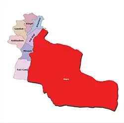
 Nara Taluka Map | |
 | |
 Nara Taluka  Nara Taluka | |
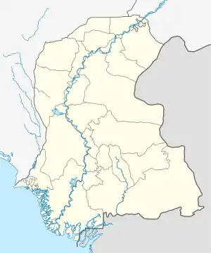
| Coordinates: 27°00′N 68°59′E / 27.000°N 68.983°E | |
| Country | |
| Province | |
| Division | Sukkur |
| District | Khairpur District |
| Capital | Choondiko |
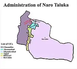
| Union Councils | Six (06)
(Dodo Faqeer Aradin)
|
| Tehsil Status | N/A |
| Government | |
| • Taluka chairman | N/A |
| Elevation | 13 m (43 ft) |
| Population | |
| • Tehsil | 160,985 |
| Time zone | UTC+5 (PST) |
| Calling code | N/A |
Nara (Urdu: نارا, Sindhi: نارو) is a taluka (tehsil subdivision) of the Khairpur District in the Sindh province of Pakistan, about 56 kilometers from the old Khairpur city.[2] Choondiko city is the Headquarter of the taluka.[3][4]
Sawan Gas field and Sawan Airstrip also located in Kathore village Ahsaanabad union council of the Nara Taluka.
References
- ↑ "District And Tehsil Level Population Summary With Region Breakup (including Nara Tehsil or Nara Taluka)" (PDF). Pakistan Bureau of Statistics, Government of Pakistan website. Archived from the original (PDF) on 29 March 2018. Retrieved 8 April 2023.
- ↑ "Zila, Tehsil & Town Councils Membership for Sindh (scroll down to Khairpur District to read Nara Tehsil)". Election Commission of Pakistan, Government of Pakistan website. Archived from the original on 5 March 2009. Retrieved 8 April 2023.
- ↑ Amin Ahmed (18 July 2020). "Locust breeding has started in Nara, Tharparkar and Cholistan: FAO". Dawn (newspaper). Retrieved 8 April 2023.
- ↑ Thar Famine Spreads To Khairpur, 2 Kids Killed in Nara Tehsil Samaa TV News website, Retrieved 8 April 2023
This article is issued from Wikipedia. The text is licensed under Creative Commons - Attribution - Sharealike. Additional terms may apply for the media files.