| National Highway 4 | |
|---|---|
| အမျိုးသားအဝေးပြေး 4 | |
 | |
| Route information | |
| Part of | |
| Major junctions | |
| West end | Meiktila |
| East end | Tachileik |
| Location | |
| Country | Myanmar |
| Major cities | Thazi, Kalaw, Taunggyi, Kengtung |
| Highway system | |
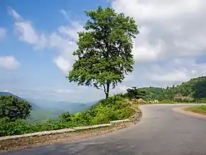
National Highway 4 is an important west–east flowing highway of central Burma. It connects the town of Meiktila in the Mandalay Region to Tachileik in Shan State in the east on the border with Thailand ( where it meets Thailand Route 1 ). The highway begins near Meiktila at 20°52′22″N 95°52′59″E / 20.87278°N 95.88306°E where it is linked by the National Highway 1 coming from the south and at Hopong it meets the National Highway 5 which goes south at 20°48′2″N 97°10′25″E / 20.80056°N 97.17361°E.
The highway ends at Tachileik at 20°26′40″N 99°52′50″E / 20.44444°N 99.88056°E.
This article is issued from Wikipedia. The text is licensed under Creative Commons - Attribution - Sharealike. Additional terms may apply for the media files.