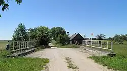
| Nereta | |
|---|---|
 | |
| Location | |
| Countries | Lithuania, Latvia |
| Region | Biržai district municipality, Panevėžys County, Nereta Municipality |
| Physical characteristics | |
| Source | |
| • location | Sargūni swamp |
| Mouth | Nemunėlis |
• coordinates | 56°11′07″N 25°05′34″E / 56.18519°N 25.09271°E |
• elevation | 69.2 m (227 ft) |
| Length | 25 km (16 mi) |
| Basin size | 108 km² |
| Basin features | |
| Progression | Nemunėlis→ Lielupe→ Baltic Sea |
Nereta (Latvian: Neretiņa) is a river of Biržai district municipality, Panevėžys County, northern Lithuania and Southern Latvia. It flows for 25 kilometres (16 mi). It is Latvia-Lithuania border river for 18 km (11 mi).
References
This article is issued from Wikipedia. The text is licensed under Creative Commons - Attribution - Sharealike. Additional terms may apply for the media files.